
San Diego was the destination for my younger son and I to visit my older son in the Summer of 2018, but the journey turned into an epic 1700 mile, 5 state, 8 national park road trip spanning 10 days. I figured since we were going to San Diego we’d try to make it interesting and maybe unforgettable. We did both!
My younger son had just graduated high school and since we hadn’t done a big Father-Son trip, what could be better than the togetherness and adventure of a good old-fashioned road trip across some of the most beautiful parts of the country. So, I pulled up my current favorite travel app Roadtrippers and starting planning.
My hope for the blog of this trip is that it will help my sons and I relive our experiences for years to come. I also hope that one day their families can read this and have some sense of our spirit of adventure and our travels to amazing places that we shared and inspire them to do the same. I’ve included some tips and don’t-forget-this type things for next time because there is always something useful I find or forget that I want to use on our next trip and hope to share some of those things with others.
Day 1 · July 19 · Denver
We flew Southwest Airlines on a really nice non-stop flight from Baltimore to Denver and arrived late afternoon. After waiting an hour in line at Budget Rental car I found out I was a Fastbreak member and we could have gone from the shuttle bus right to our car. Lesson learned – thoroughly read your emails and sign up for a program with privileges that may keep you from waiting in long lines at the Denver rental car companies.
We drove into Denver and checked-in at the Hampton downtown around 6-ish. We just used the valet since it was getting late and we were tired and hungry. We ate dinner at the nearby Yard House, an excellent restaurant for both the food and atmosphere, not to mention 115 beers on tap. Afterwards we walked to the 16th Street Mall, a beautiful street with a treed center island, stores and restaurants that is a little over a mile long and very pedestrian friendly.
Day 2 · July 20 · Denver & Boulder
After a nice and familiar Hampton Inn breakfast we headed north of downtown to visit my Cousin Jim and his wife Cherry both of whom we’d never met and never knew existed until a year before. We visited with them for a while and they gave us a map of Flagstaff Mountain outside Boulder for some scenic hiking. Then they treated us to a great lunch at Ted’s Montana Grill. We found them to be really great and interesting people and we thoroughly enjoyed our time with them. Hearing Jim’s accounts about our family in times before I was born, and Cherry’s historical Colorado lineage were fascinating and sparked a renewed interest in my mother’s family history. When we find ourselves back in Denver we’re definitely going to visit again and next time lunch or dinner will be on us.

A road trip supply run to the Wal-Mart near our lunch spot was in order so we provisioned with 6 gallons of water, Windex, paper towels, a styrofoam cooler, apples, ziplock bags and a week’s worth of peanut butter and jelly ingredients. These turned out to be critical during our travels because most of our trip would be sunny, 100+ degree days. Dehyradation and “hangriness” are just bad things that we were able to avoid. The windows in our car were dirty when we picked it up, thus the Windex, and we were able to keep them clean the entire trip. Tip – always carry food and more water than you think you’ll need, and a box or bungee cord could be handy to keep the water jugs and other things from sliding around in back of the car.
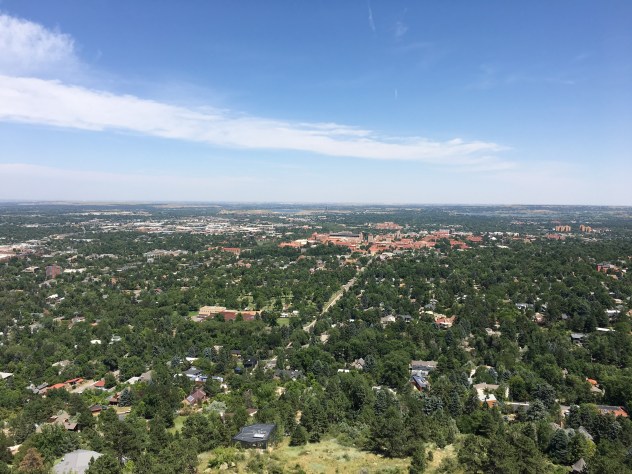
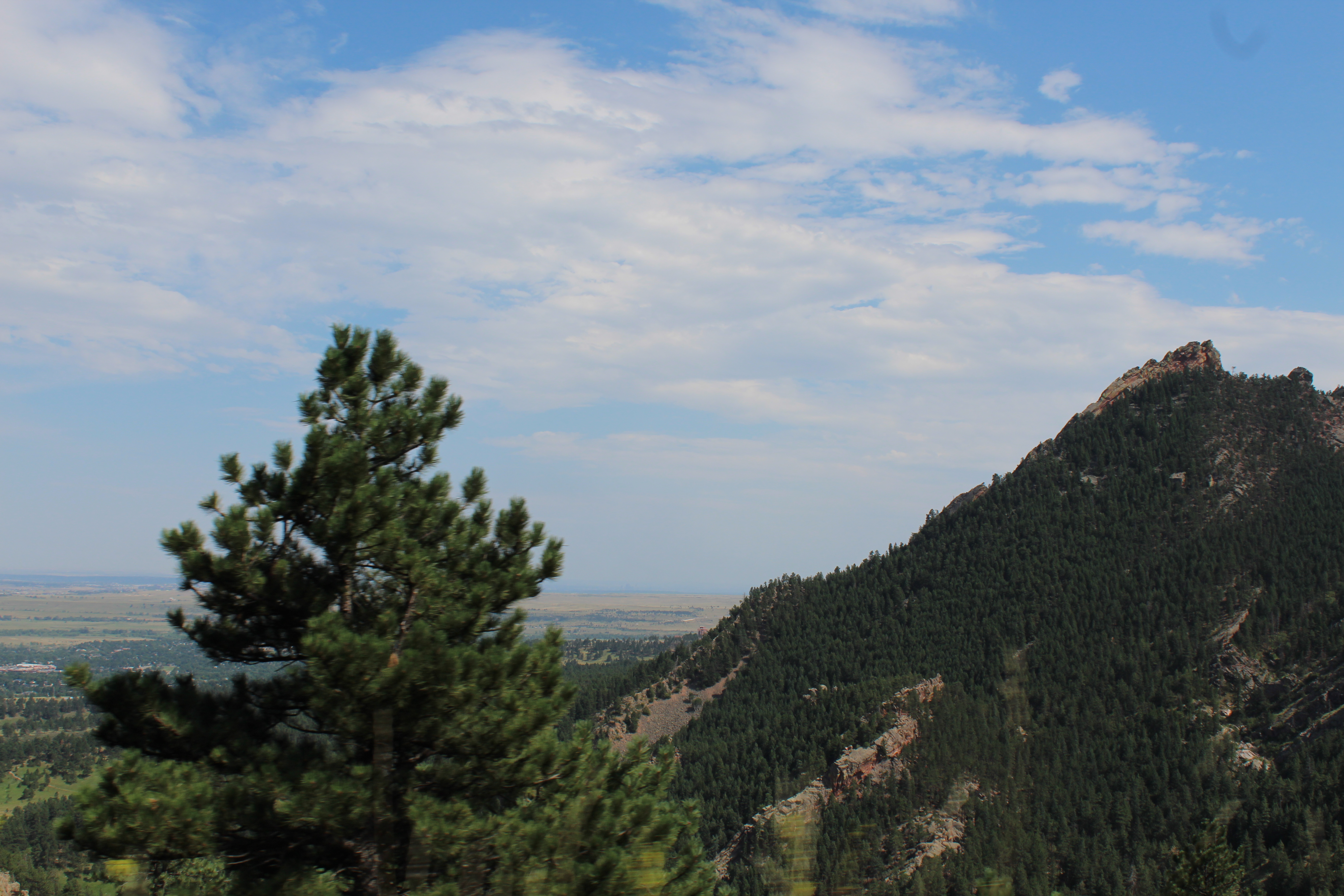
Fully provisioned, we drove up a windy road to Flagstaff Mountain overlooking Boulder. There are amazing viewpoints of the Flatirons to stop and hike to along the road but you can see them from the car. At the top we took-in excellent views of Boulder and the surrounding area and walked along a trail that went around the rim of the mountain.

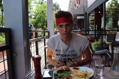
We decided it was time for an early dinner, so we left Flagstaff Mountain and drove down to Boulder where we walked around the very cool Pearl Street Mall, a street similar to 16th street in Denver but with its own hip vibe. The West Flanders Brewing Company turned out to be a great place to grab a couple of burgers at an outside table.
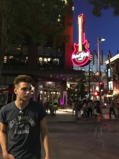
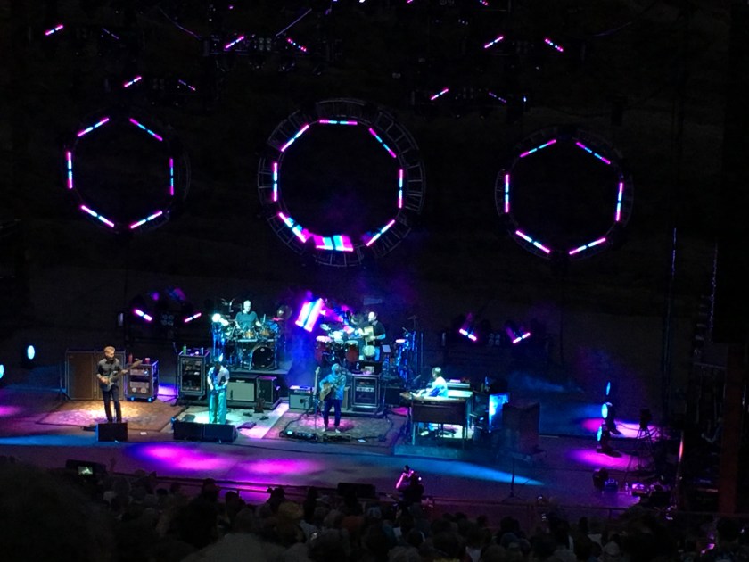
After dinner we stopped in a retro store called Rag Stock. The store brought back a lot of memories and my son bought some 1980’s wear. We then drove to the Redrock Canyon Amphitheater to see The String Cheese Incident, a band I’d never heard of until planning the trip a month or so earlier. I thought a concert at the Amphitheater would be pretty cool but it blew-away all of my expectations. Not only was it the best concert I’ve ever been to, it was one of the best times I’ve ever had. The band was incredible, and the crowd was crazy. Everybody danced all night long and my son and I left around midnight wearing our own The String Cheese Incident t-shirts, vowing to come back to Denver just for this concert if it happened the next year.
Day 3 · July 21 · Denver to Boulder, Estes, and Rocky Mountain NP
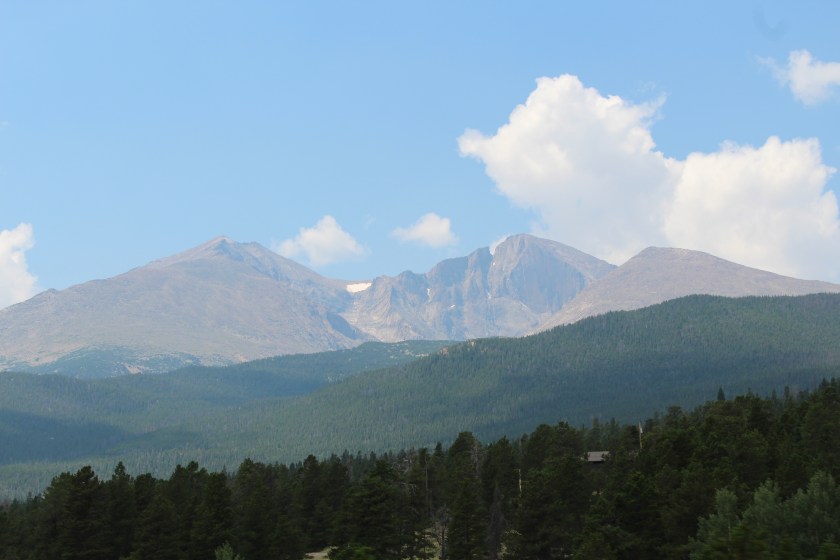
We left Denver in the morning and drove up to Boulder where we made a quick stop at Rag Stock again. I bought several 1980’s t-shirts and my son bought several 1980’s jackets. The 80’s are back… actually they never left in my mind and somehow my millennium year born son is a child of the 80’s too. We continued on our drive north to Estes and were greeted by an incredible view of Longs Peak.
We stopped to register at Backbone Adventures in Estes and after a 16 mile drive south to the trail head we picked up the ATVs and rode some fairly deserted trails in the Rockies. The trails were quite rocky as the name implies but we had a really great time, filming ourselves riding ATVs in our suits and ties that my son had mandated we bring. I’m sure glad he made me bring my suit.

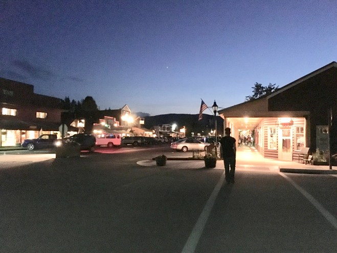
Afterwards we drove back to downtown Estes which is a really cool and walkable town with a main street, shops and restaurants. We had an excellent but very late lunch at Claire’s On The Park, filled the gas tank, and took off for Rocky Mountain NP which is basically next door to Estes. Tip – top off your car’s gas tank frequently when travelling out west through the mountains and on long stretches of desert road and you’ll worry a lot less about running low on gas. I never let the tank get below half.
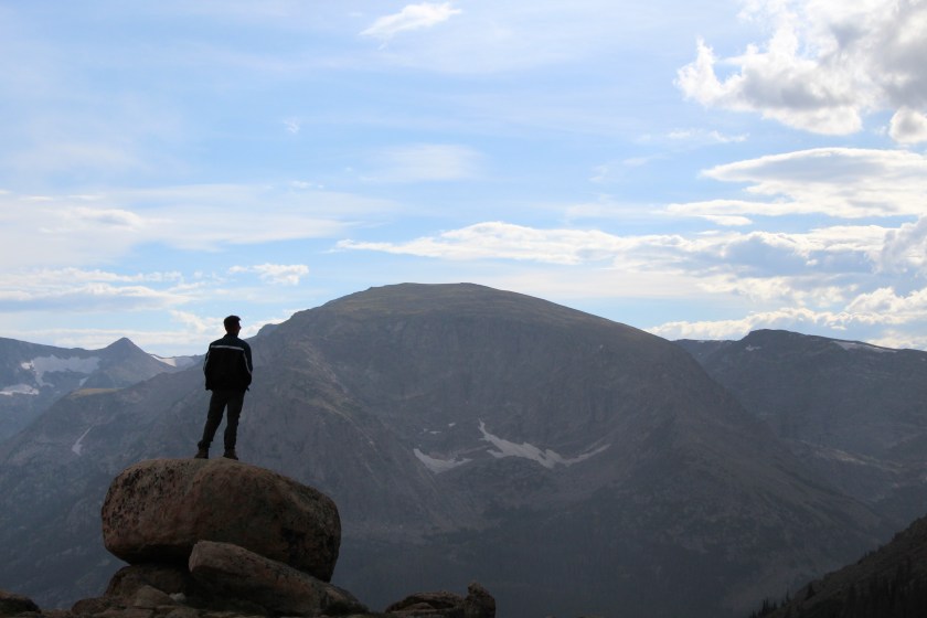
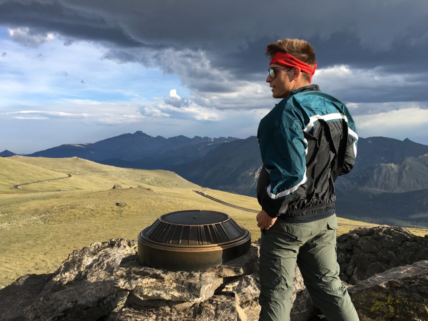
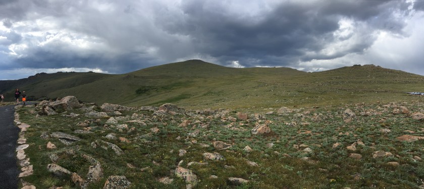
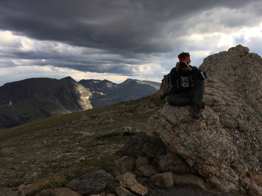
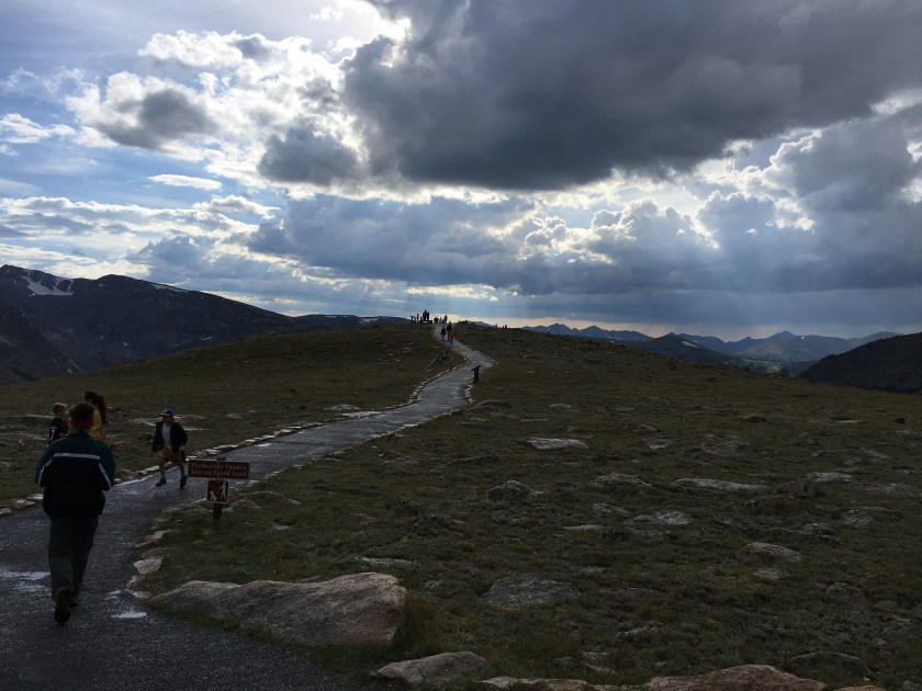
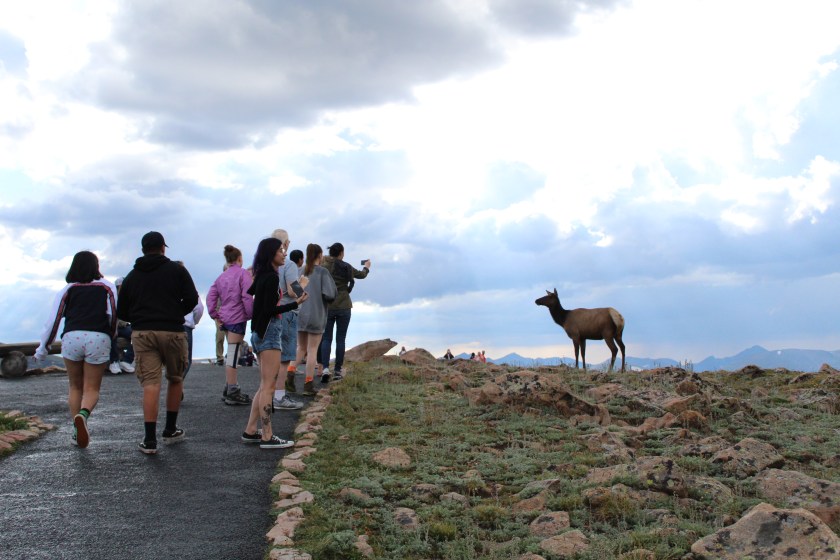
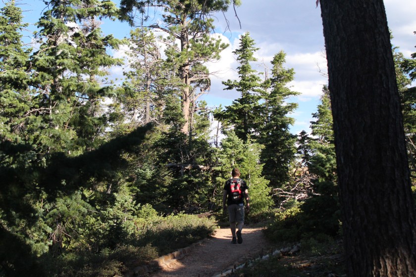
Rocky Mountain National Park is hard to put into words but if I had to pick a few they would be magnificent, beautiful, and awe-inspiring. You have to be there and see it to get a feel for the massiveness of the mountains and space. The drive to higher elevations traverses beautiful pine forests where the trees become smaller and then suddenly disappear. If you aren’t used to the altitude you may find yourself out of breath on some of the short climbs and trails to view points. Do as many of them as you have time for and make sure your camera battery is fully charged and you have plenty of space on your memory cards for photos. Tip – bring a jacket since the weather is colder at 12000+ feet and can change rapidly. It is frequently very windy and storm clouds with rain and lightning can pop-up suddenly in the Summer. It was 91 degrees in Boulder but windy and 59 degrees at the higher elevations in Rocky Mountain National Park. Elk are common and can get very close to visitors on some of the trails.

From the highest view-point in Rocky Mountain NP it was about an hour drive to Grand Lake in the southwest corner of the park. There are many places to stop along the way and in the evening, you are likely to see moose in the meadows and elk on the hills along the route. We arrived at Grand Lake a bit past 8 o’clock and checked in to the Bighorn Lodge whose slogan is America’s Best Value… funny, very funny. The best thing about it was the Polish exchange student with beautiful blue eyes working there who shocked me by being the only person outside my family who has ever pronounced my last name correctly the first time, and with an accent too. She pointed us to the Sagebrush BBQ & Grill which had a great western atmosphere and service, and really good food for the price.
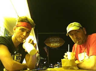
After dinner we stopped at Dairy King for a very nice malted milkshake and root beer float. Grand Lake is a cool little town with a old-style main street. It felt a little deserted until we walked by the town center pavilion where a couple hundred people were playing bingo. That’s where almost everybody was on Saturday night. It looked like fun, but we were dead-tired, even for bingo.
Day 4 · July 22 · Grand Lake, CO to Moab, Arches NP, and Canyonlands NP Utah
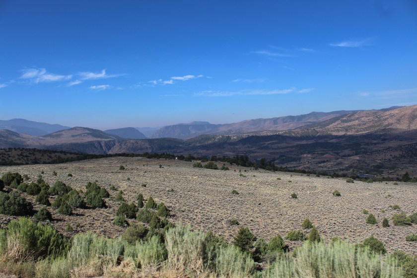
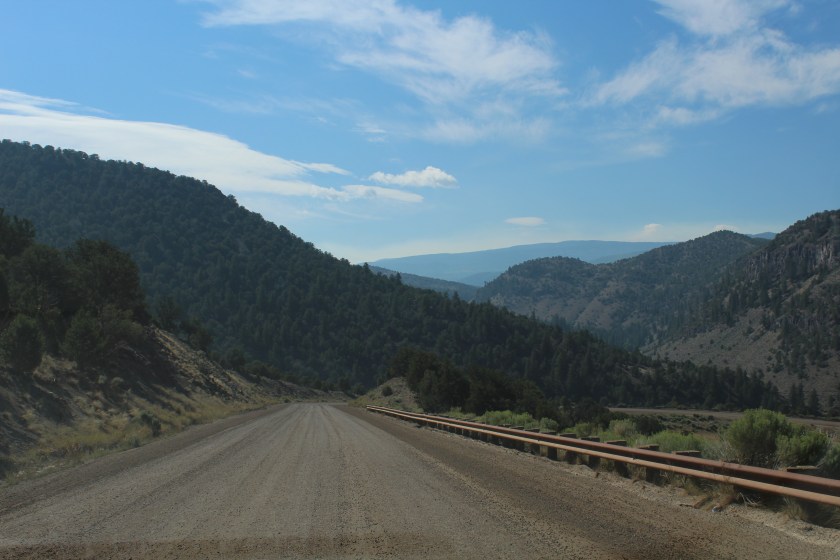
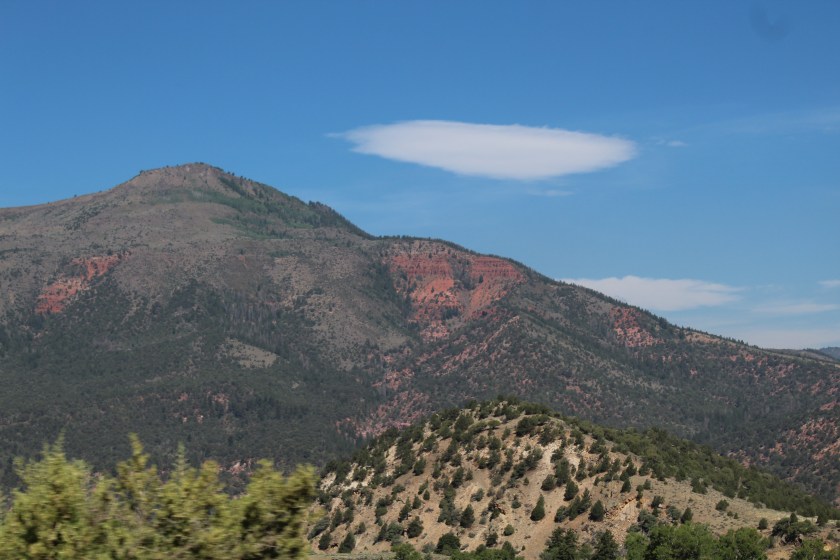
We woke to a cool and crisp 52 degrees in Grand Lake and walked to a great breakfast buffet at the Fat Cat Cafe’. At breakfast I asked my son why they had all of the pictures and cartoons of cats on the walls. My son said, “It’s the Fat Cat Cafe’ Dad”… oh right. After breakfast we packed-up and headed out on the longest point-to-point drive of our trip, 5+ hours. I always look for routes that may add interest to a road trip without sacrificing too much time. Sometimes big long highways can be boring. So, I picked a few waypoints to force Waze to take us on a less travelled path; Grand Lake – Hot Sulphur Springs – Kremmling – State Bridge – Moab. Trough Road is a dirt and gravel road about 20 or so miles long that goes through State Bridge and it was really cool to feel like we were in the middle of nowhere on that road. It was one of the highlights of our trip and we are so glad we did it.
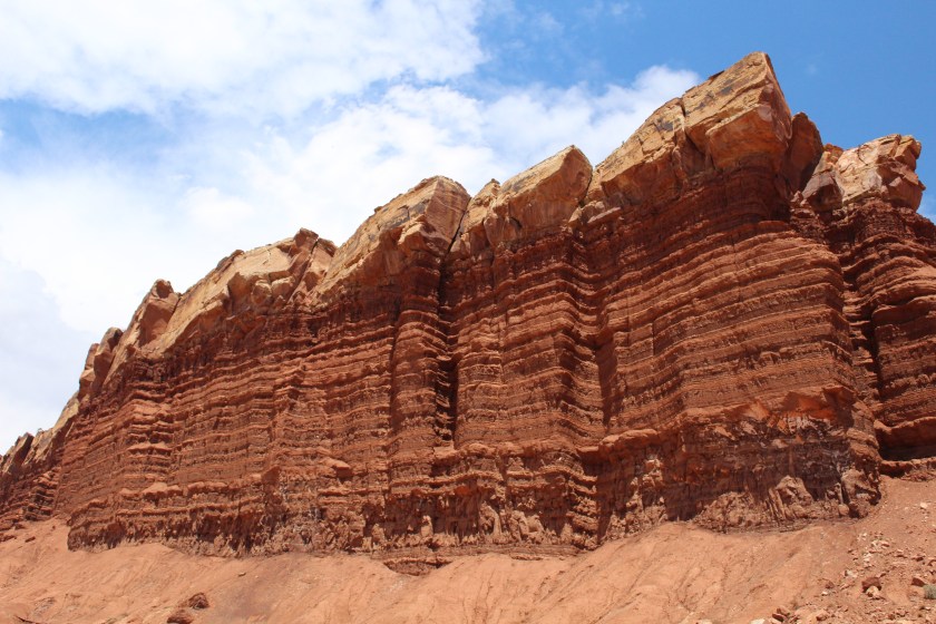
We stopped at a lot of very scenic viewpoints along the road to Moab and that added an hour or two to our drive. The landscape varied from trees and mountains, to meadows, to canyons with progressively different colored rocks, all stunning as shown in the photos below. Tip – download a map to your phone, use a real GPS, take screen snaps of your route beforehand or have a paper map handy because cell service can be very spotty in this part of the country and you may periodically lose your phone navigation. The screen snaps helped us a lot.
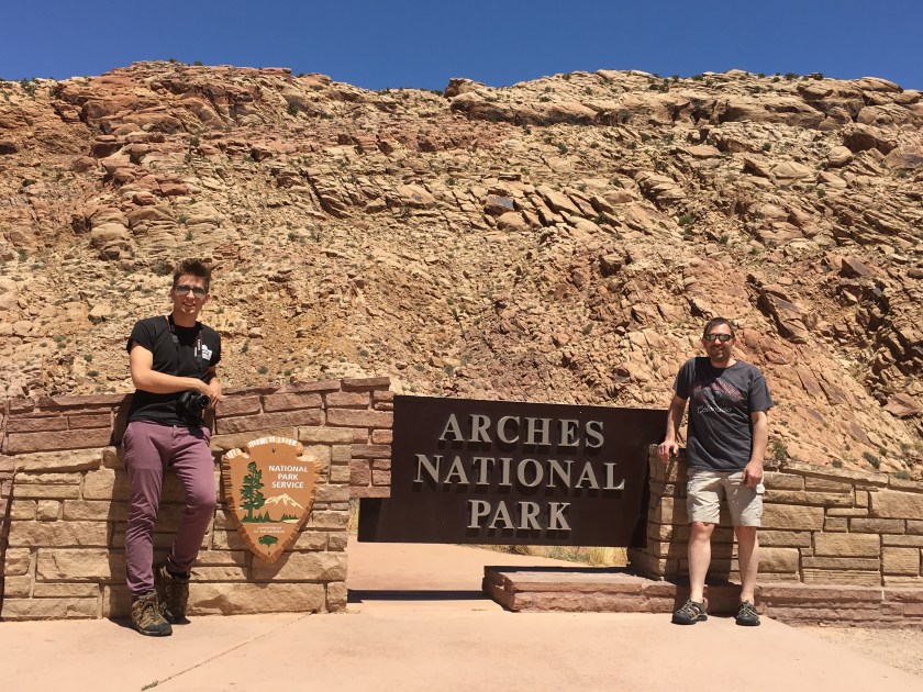
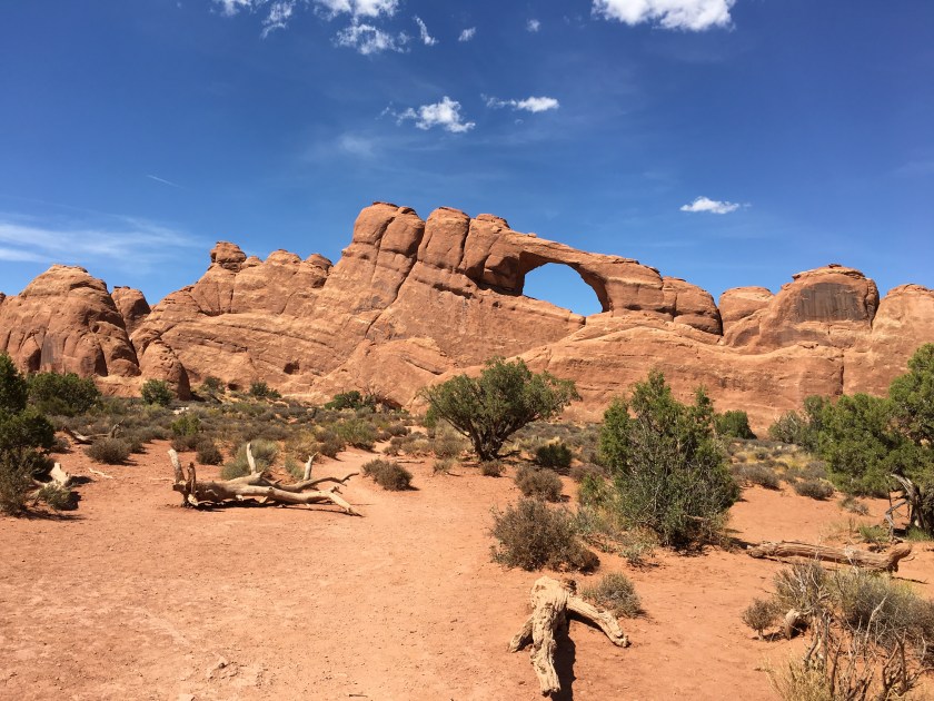
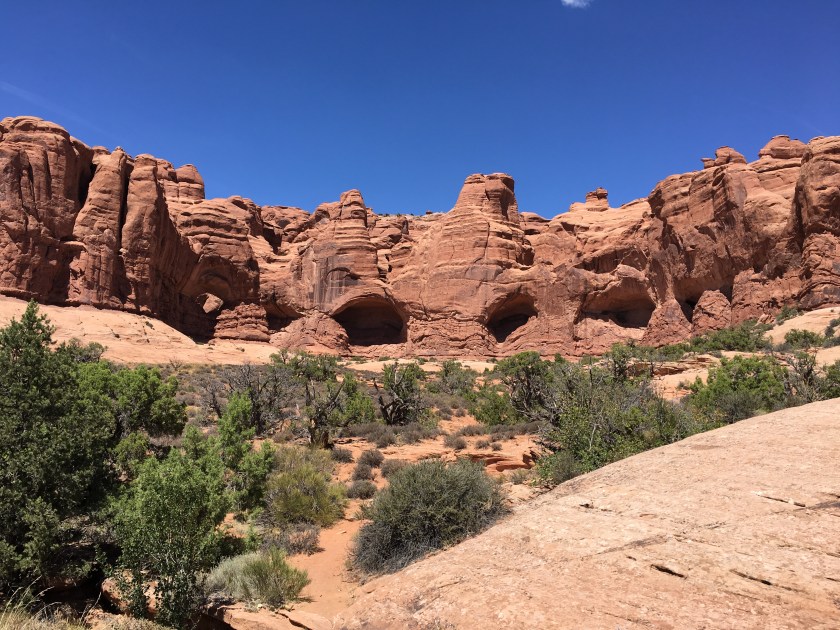
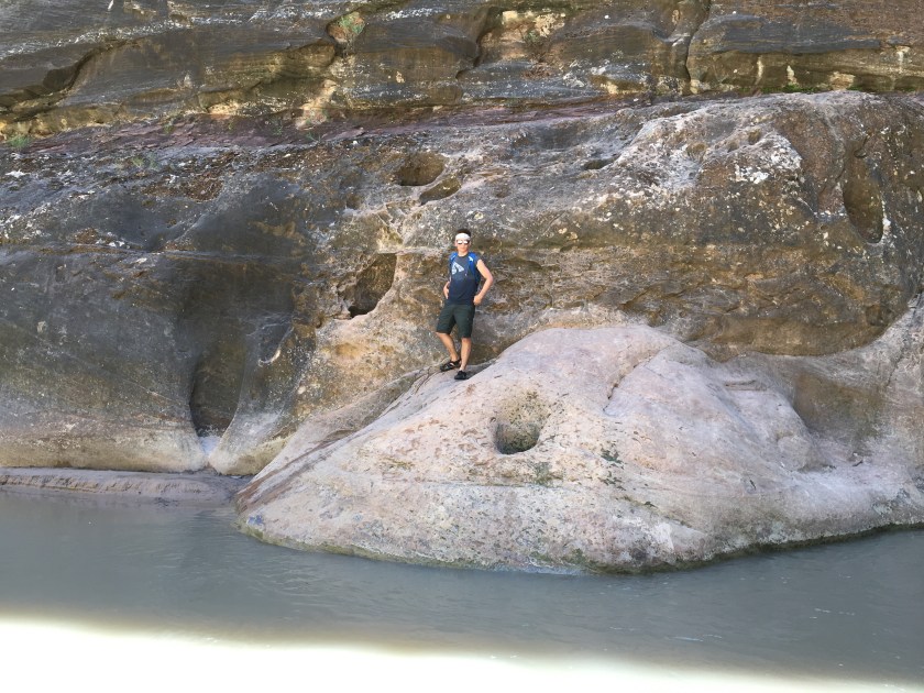
It was approaching 4 o’clock as we reached the Moab area, so we decided to head directly to Arches NP, got our park stamps at the visitor center then headed up a winding road leading into the park. The massive red-orange rock formations in Arches thrust out of the ground in clumps, separated by contrasting yellow and reddish rolling desert hills. It was 105 degrees and a bit crowded in the popular spots, so we kept hiking to a minimum in those locations. The relentless sun and high temperature made large numbers of people coming back on a couple popular trails look like death. Not a problem… we got really great photos from a distance and shorter, less crowded paths were still amazing.
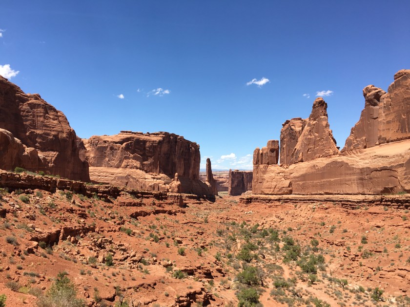

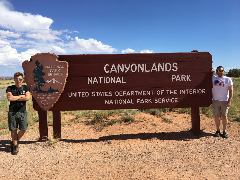
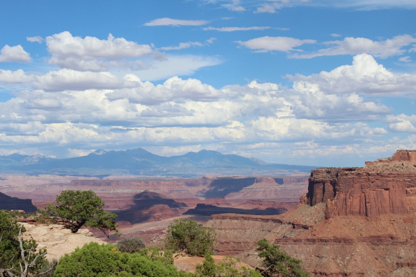
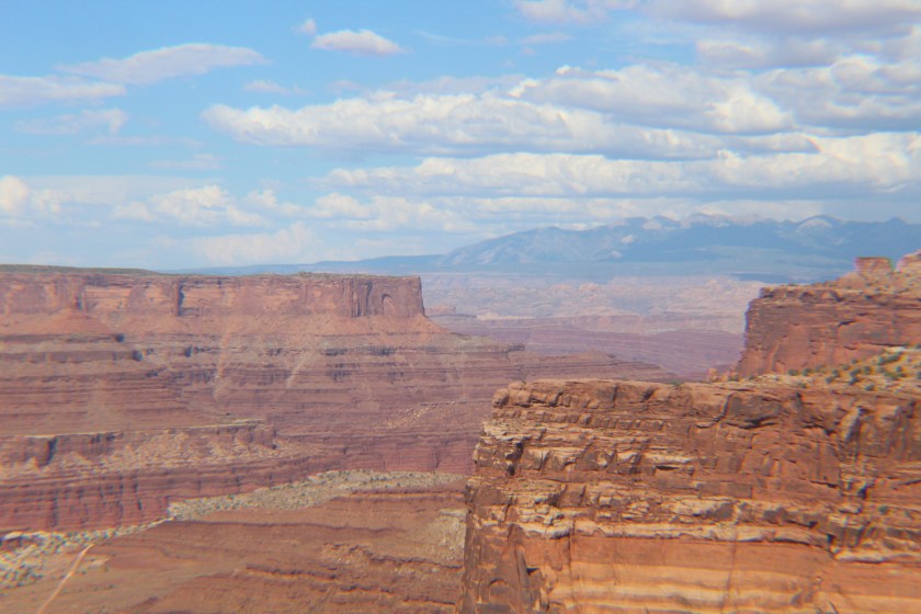
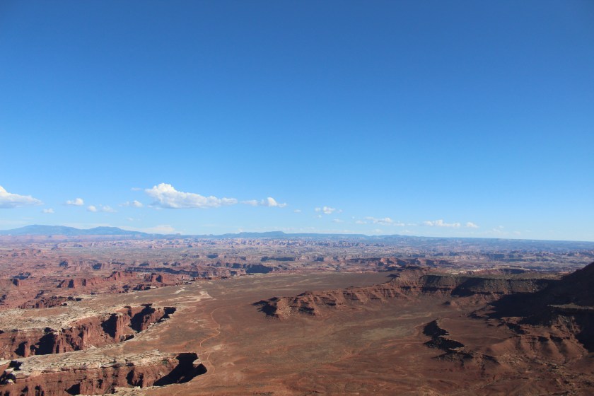
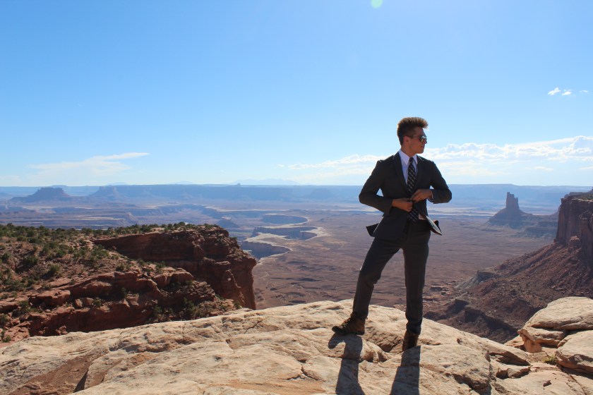
We spent a couple of hours in Arches then backtracked north on the road to Canyonlands NP. Canyonlands kind of creeps up on you. In Arches we drove along desert roads looking up at rock formations. In Canyonlands you suddenly realize you are driving on top of a giant rock formation looking down on massive canyons inside of canyons. We found several truly spectacular vista points where my son put on his suit and we took some once-in-a-lifetime, hang on the wall type photos. Canyonlands is a stunningly beautiful place and far exceeded our expectations. It turned out to be my personal favorite on the road trip.
Day 5 · July 23 · Moab to Capitol Reef, Grand Staircase-Escalante & Bryce Canyon NPs
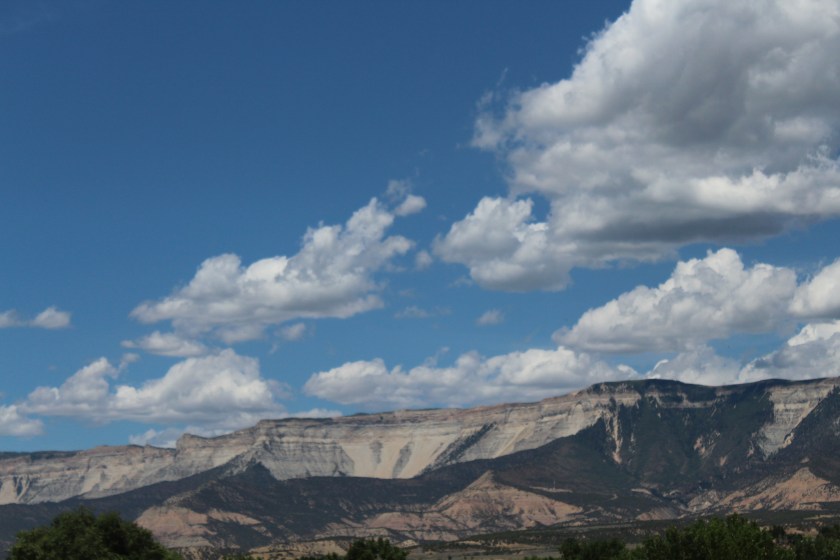
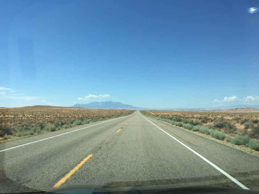
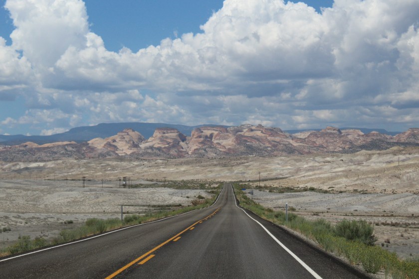
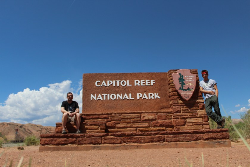
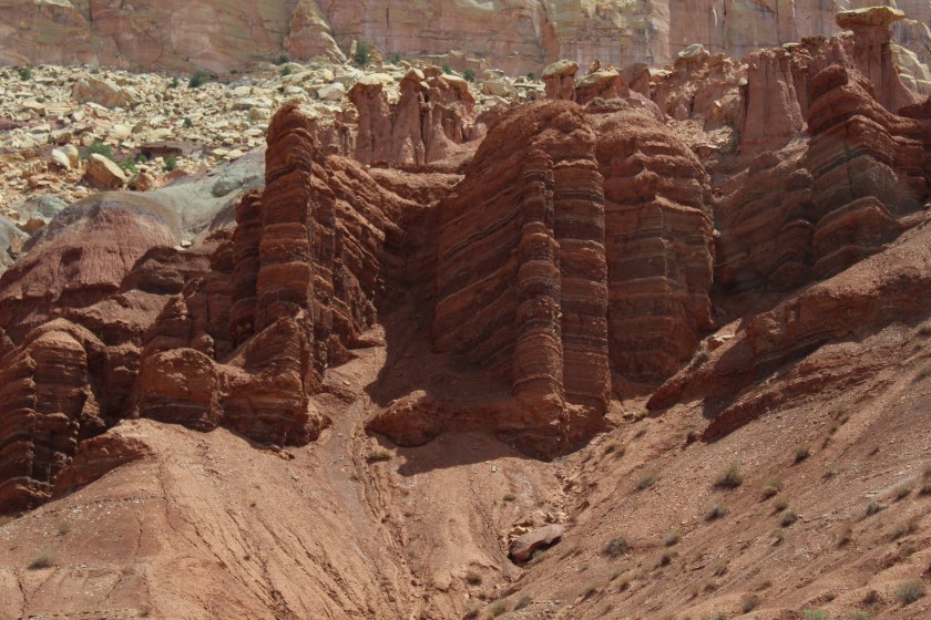
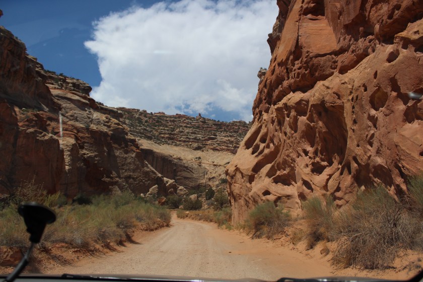
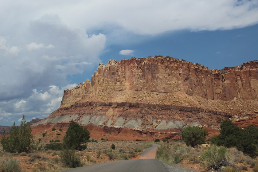
Heading from Moab to Capitol Reef NP, we drove through expansive stretches of wide-open desert where Route 24 seemed to never end. At points we found ourselves alone on the road, not seeing a car for miles in either direction. I’ve only experienced that kind of immense open space feeling of freedom in a handful of other places in my life. Long straight desert roads led us to some moon surface like rock formations and canyons as we approached Capitol Reef NP. You don’t hear a lot about Capitol Reef and it seems to be somewhat underrated, but we found it to be both beautiful and spectacular.
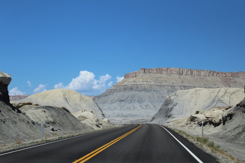
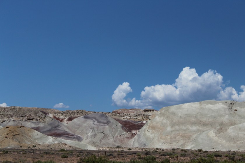
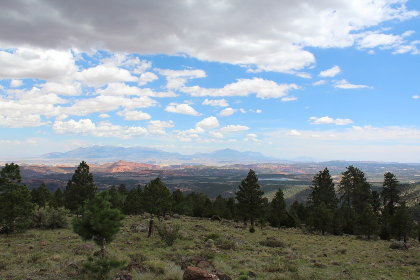
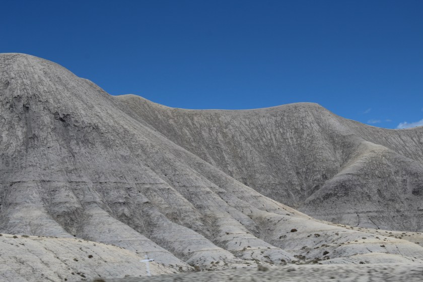
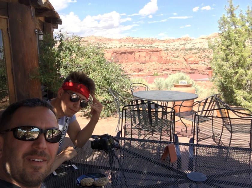
The drive onward to Grand Staircase Escalante was mostly desert that suddenly turned into mountains lush with trees near a town called Grover. A storm came across the mountain and it briefly rained and hailed on us. We drove further south through a town named Boulder and back into desert canyons where it seemed like we were in the middle of nowhere again. But to our amazement we suddenly stumbled upon the Kiva Koffeehouse, a real coffee shop perched up on a cliff overlooking a canyon and the Escalante River. We stopped in and I got a coffee while my son got a Hot Cocoa and we enjoyed some excellent, warm and chewy chocolate chip cookies while taking in the views on the outside patio. What a cool spot for a coffee shop.
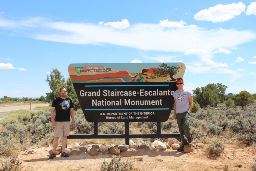
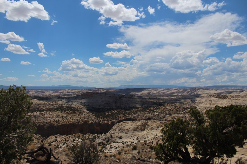
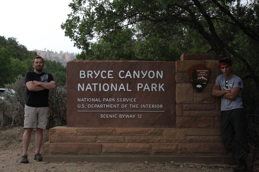
It was later in the afternoon when we arrived in the town of Escalante and the visitor center had closed so we were unable to get our cancellation stamps. We made the command decision to push forward to Bryce Canyon and leave the exploring of Grand Staircase Escalante further south for another trip out west. About 90 minutes later we were pulling into Bryce Canyon NP.
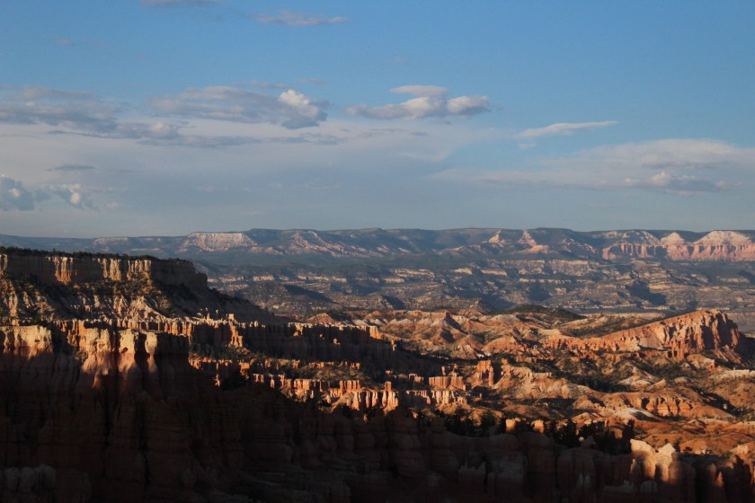
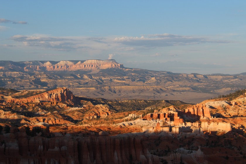
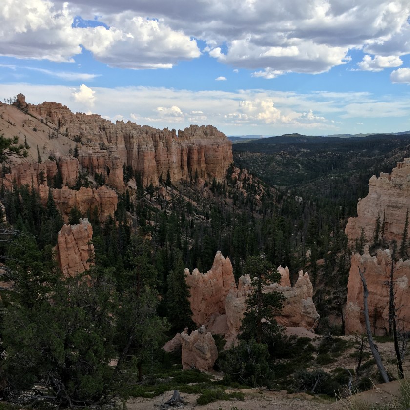
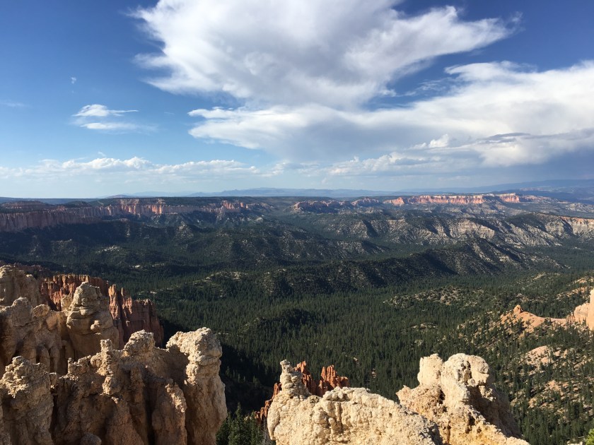
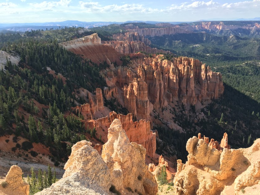
Bryce Canyon is another park where the spectacular creeps up on you. Driving into the park we were greeted by beautiful pine forest and there were several short access roads to viewpoints as well as several pull-offs on the main road. As we approached the first break in the trees that revealed some orange rock formations in the distance, the view suddenly opened-up and we were blown away by the awesome expanse of the canyons and rugged landscape as far as the eye could see.
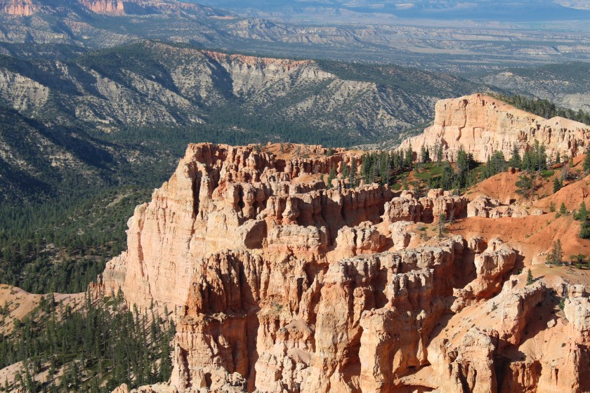
Bryce is a favorite National Park for many people and it’s not hard to see why. The contrast of beautiful deep green pines among the orange and white rock formations called Hoodoos make for some world-class photo opportunities. We drove to the end of the road and looked out on an absolutely massive and breathtaking vista spanning dozens of miles wide and deep. It made me feel like a speck on the landscape.

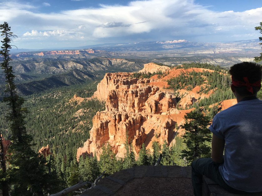
We stayed as late as we could taking in the views of Bryce until we had to check in to our motel for the night, the Bryce Canyon Resort. Next time we visit Bryce I will book way ahead of time and try to stay somewhere else, like in the little town area near the park or we can just camp. It was too late for dinner at the Canyon Diner and the wait was too long at Ruby’s Inn Cowboy Buffet so headed to the restaurant at the Bryce Canyon Resort. We were served a burger with half-cooked bacon, and leather like chicken fried chicken that got sent back to the kitchen. We’ll get to Ruby’s early next time!
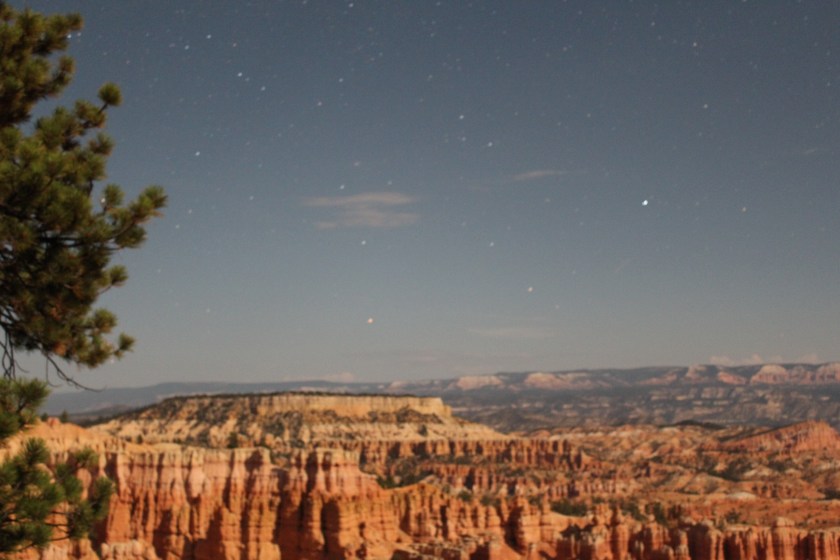
A had a trail bar dinner as we drove back into Bryce Canyon for some star-gazing and night photos. My son used his digital SLR to take long exposure moonlit photos of the canyon and night sky. Amazingly the photos he took of the dark canyon looked like they were taken in daylight and several of the star photos turned out to be a great surprise.
We walked down a path along the top of the canyon to two telescopes that the lodge had set up to view Mars and Saturn as part of their astronomy program. We could see the rings of Saturn which were really cool and the faint orange glow of Mars. Later they trained a telescope on a binary star named Albiero which was really cool.
Walking back along the path towards our car after 11pm there was some critter that seemed to be stalking us. It was probably the size of a house cat or a bit larger, but it creeped us out, so we wasted no time getting back to the car. All in all, it was an amazing night of stargazing and photography overlooking the canyons and we’ll never forget it.
Day 6 · July 24 · Bryce Canyon to Zion NP and Las Vegas
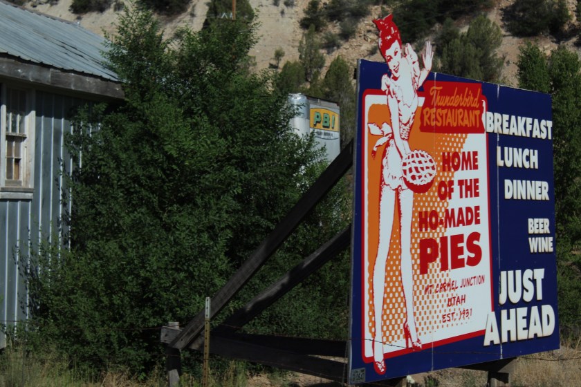
We woke-up super hungry and since the breakfast at the Bryce Resort Restaurant was free we decided to take another chance and test it out. It turned out to be pretty good and we were happy to fill up before the two-hour drive to Zion. The road was winding and passed through miles of red rock formations before finally turning into gentle desert hills covered with brush along Route 89. Brush turned into trees as we passed through a section of the Dixie National Forest until we hit our turn at Mt. Carmel. There we saw a funny sign and regret not stopping at the Thunderbird Restaurant – Home of the Ho-Made Pies, just to check it out.
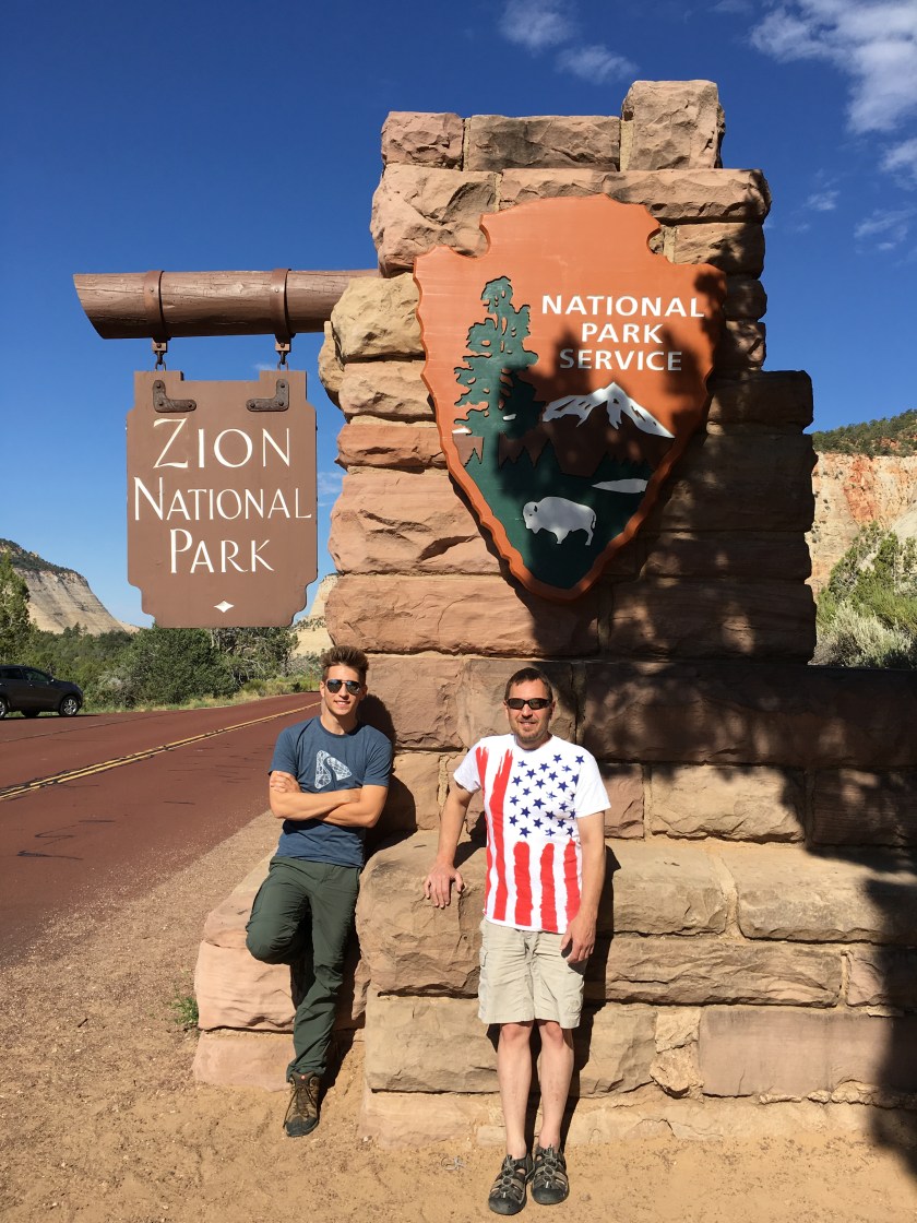
Not more than 10 miles from Mt. Carmel we hit the east entrance of Zion NP. The east entrance is a winding road through some beautiful rock formations and a narrow tunnel where we waited for about 10 minutes for some larger vehicles and RVs to come through from the other direction. There are a couple of places to stop and get pictures along the road before it ends at the main north-south road through Zion not quite a mile north of the Visitor Center.
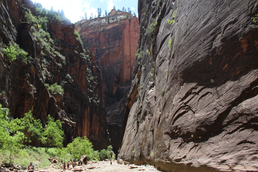
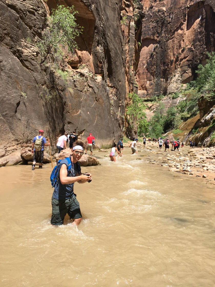
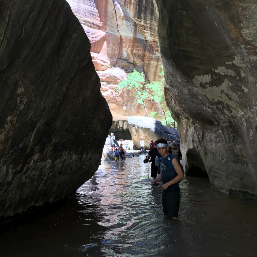
The Zion NP Visitor Center has a pretty big parking lot, but it quickly fills-up so if you roll in late morning or lunch time you’ll be extremely lucky to find a spot unless someone else is leaving. Otherwise you have to drive a mile south to Springdale, find a place to park and hop on a bus to take you to the visitor center. Fortunately, we lucked-out and found someone leaving so were able to save an hour by parking right at the visitor center. Cars are prohibited along most of the main north-south road through Zion, but I believe if you stay at the Lodge in the park you can at least drive that far. Buses run constantly from Stop 1 at the visitor center to stop 9 at The Temple of Sinawava. We waited about 30 minutes, mostly in hot sun so be prepared since lines can be longer that. Stop 9 has bathrooms and water and was our destination, the start of the famous slot canyon water trail called “The Narrows”.
We wore our waterproof Keen Sandals which I thought were the perfect shoe for hiking through the river and dry rocky shoreline, having used mine to hike from the visitor’s center to The Temple of Sinawava and The Narrows the Summer before with no issues. My son’s Keen’s actually fell apart after hiking about 2 miles up the river. We used all our emergency duct tape when the first one’s sole delaminated and after it happened to the second sandal he just took his shoes off since they posed a tripping hazard and were pinching his toes. Do not try to go barefoot on this trail as you will likely get hurt! You can rent special water shoes and a walking stick near the start of the trail and I’d highly recommend the shoes at a bare minimum. We wound up having a great time in spite of the shoe problems since the hike is so unique and the scenery mind-blowing. I found Hiking The Narrows to be a very detailed and excellent guide to planning your hike.


Angel’s Landing was my son’s #1 trail he wanted to hike on our road trip. But flooding from a storm 13 days before we arrived had destroyed parts of the trail and it was closed indefinitely. The Upper Emerald Pools and Kayenta trails had also been badly damaged and were closed too. Feeling hungry from the hike and wanting some fuel before the 2 1/2 hour drive to Vegas, we headed into the town of Springfield and found Switchback Jack’s Sports Grill, a nice bar and restaurant with great food and awesome 70’s rock-n-roll.
The first hour of the drive to Vegas took us through countless mesas and beautiful canyons. Right after the Virgin River Gorge and about 10 miles from the Utah-Nevada state line, the rocks ended abruptly and the desert opened-up to welcome us to fairly flat wide open driving all the way to Vegas.
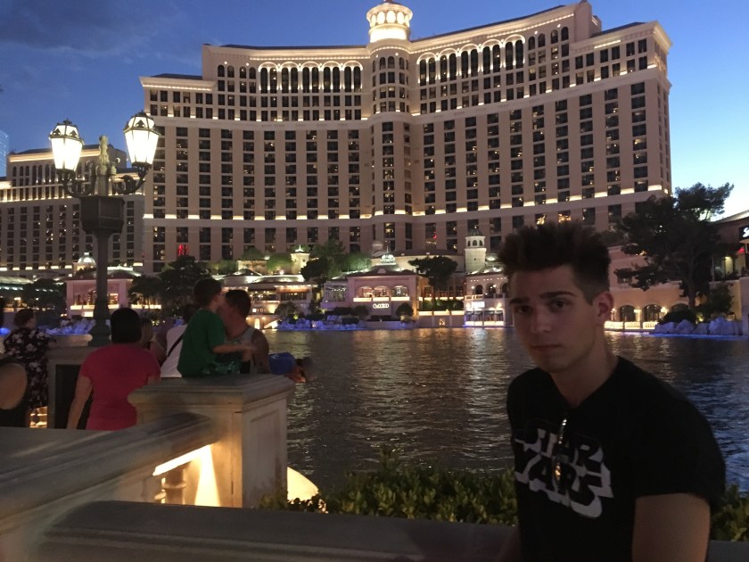
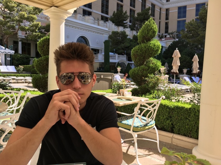
Arriving in Vegas about 8pm we checked in to the hotel and raved about the luxury of our room and the city-like size of the Bellagio. This was definitely on the other end of the spectrum compared to our motels in Grand Lake and Bryce and was amazingly half the cost. We watched the fountain show in front of our hotel then walked around for a while including a detour through the 1-mile mall to cool off from the 99 degree temperature. It’s too bad we only had a short stay there. Vegas is a crazy hot really cool place.
Day 7 · July 25 · Las Vegas to Hoover Dam and Lake Havasu
Breakfast at the Ballagio Pool was a lot less crowded and faster than standing in line for the hotel buffet inside, but the temperature was 101 degrees. We thought it worth the tradeoff since we wanted to get on the road and it turned out to be some really good food.
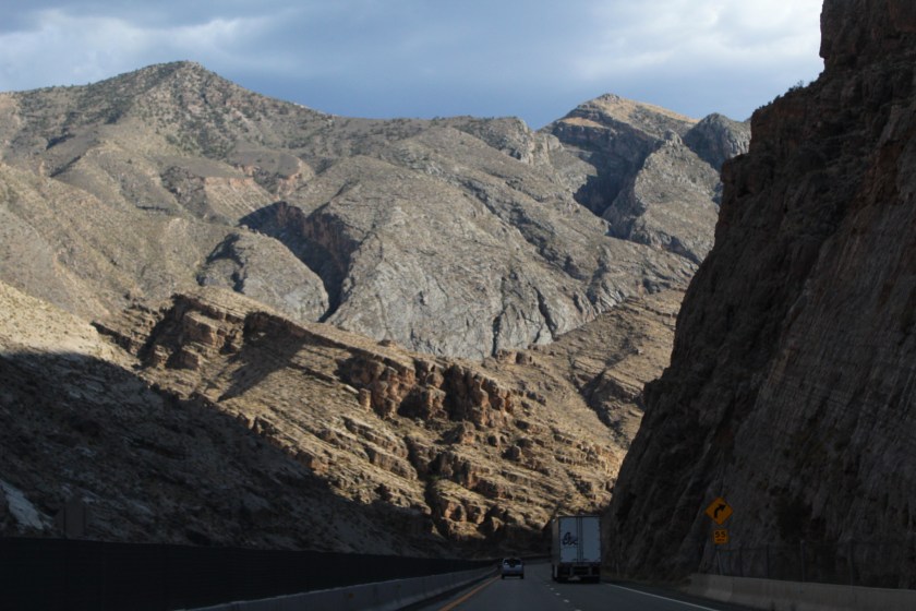
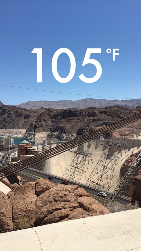
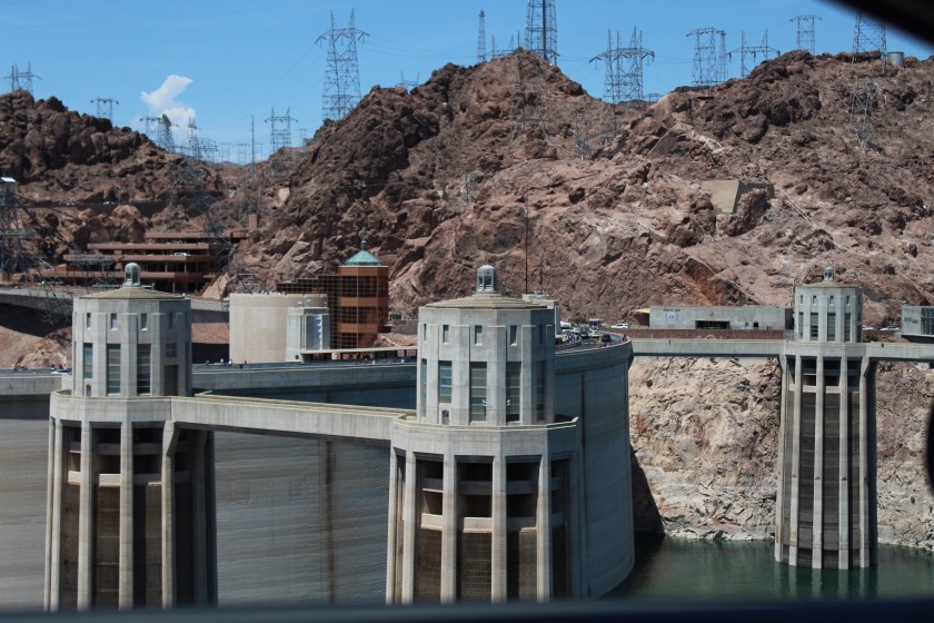
Not quite an hour out-of-town we drove through the Hoover Dam. We didn’t stop at the visitor center or take a tour, but we parked at an overlook for a few minutes to take some photos and that was good enough for us that particular hot and crowded day there. We also opted out of the walk up to the RT 93 overlook… too many people and too hot for us!
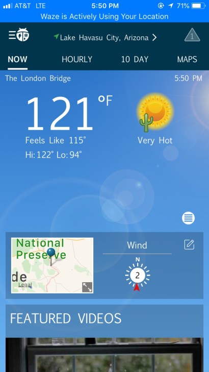
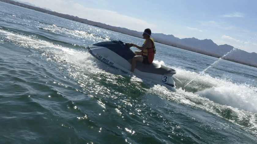
The drive from the Hoover Dam to Lake Havasu was mostly long stretches of desert and the temperature increased steadily the closer we got. When we arrived in the afternoon it was 121 degrees according to WeatherBug. In the sun it felt like our skin was going to burst into flames. It was the closest to spontaneous human combustion that I ever hope to get. The lake looked refreshing, so we decided to rent a couple of jet skis and get wet. The lake temperature was great, and we took frequent dips due to the hair dryer like temperatures of blowing hot air while jet skiing.
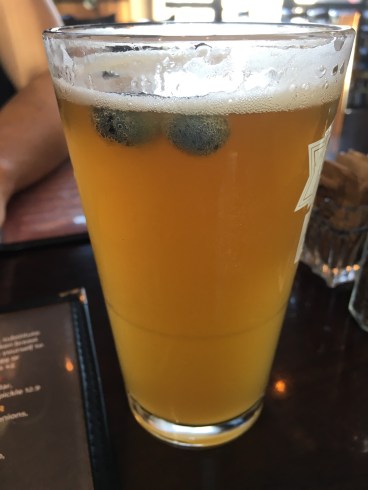
Jet skiing was a ton of fun and we’d worked up an appetite. A search for brew pubs turned up the College Street Brewhouse & Pub. We had excellent hamburgers in a nice atmosphere there. I had possibly the best beer I’ve ever tasted – a blueberry wheat beer called Big Blue Van, brewed in-house. They even put a half-dozen blueberries in it. It was divine.
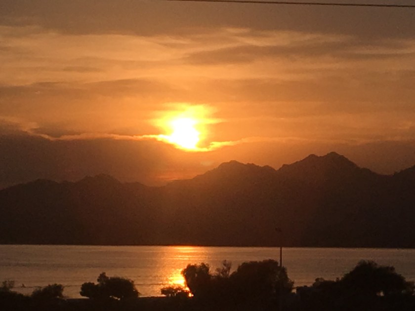
Arriving back at our hotel we saw one of the most beautiful sunsets over the mountains across the lake. Perfect ending to a fun and hot day.
Day 8 · July 26 · Lake Havasu to Joshua Tree NP, Palm Springs and San Diego
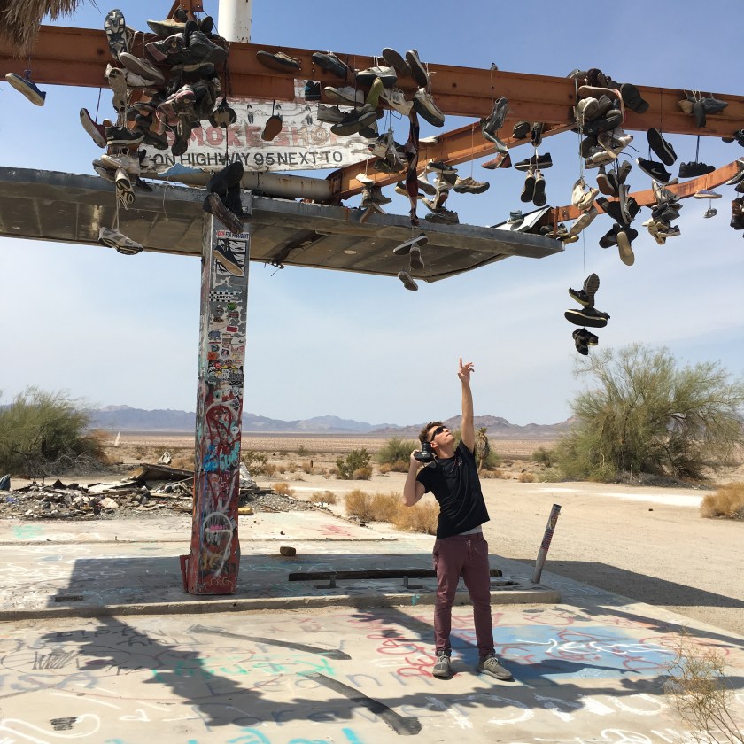
We enjoyed a familiar Hampton Inn breakfast and started our drive south from Lake Havasu through the desert and rocky outcroppings until we hit California highway 62. There we found a stretch of about 15-20 miles where people had constructed rock, stick and railroad tie graffiti, visible from Google satellite photos, along the railway that parallels the highway. My son found the famous shoe fence on the site of an abandoned gas station in the ghost town of Rice, where all that was left was the little roof that once provided shade over long since gone gas pumps. Somehow it felt totally appropriate to sacrifice my son’s Keen sandals there.
After the ceremony he gave the Lonely Palm the rest of the water in one of our gallon jugs and we headed toward Joshua Tree NP.


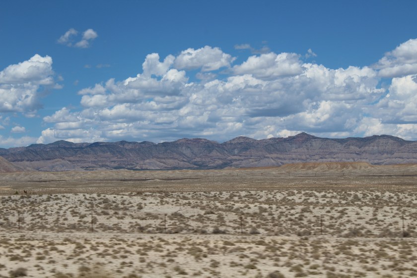
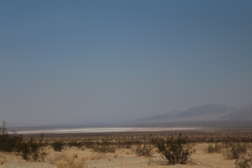
We drove through long stretches of desert where the road seemed to have no end. A few miles from Rice we saw a small white sliver of land that grew into what we assumed was an ancient salt flat a couple of miles across. I’d never seen a dried-up salt lake before and it was a strangely eerie site from a distance.
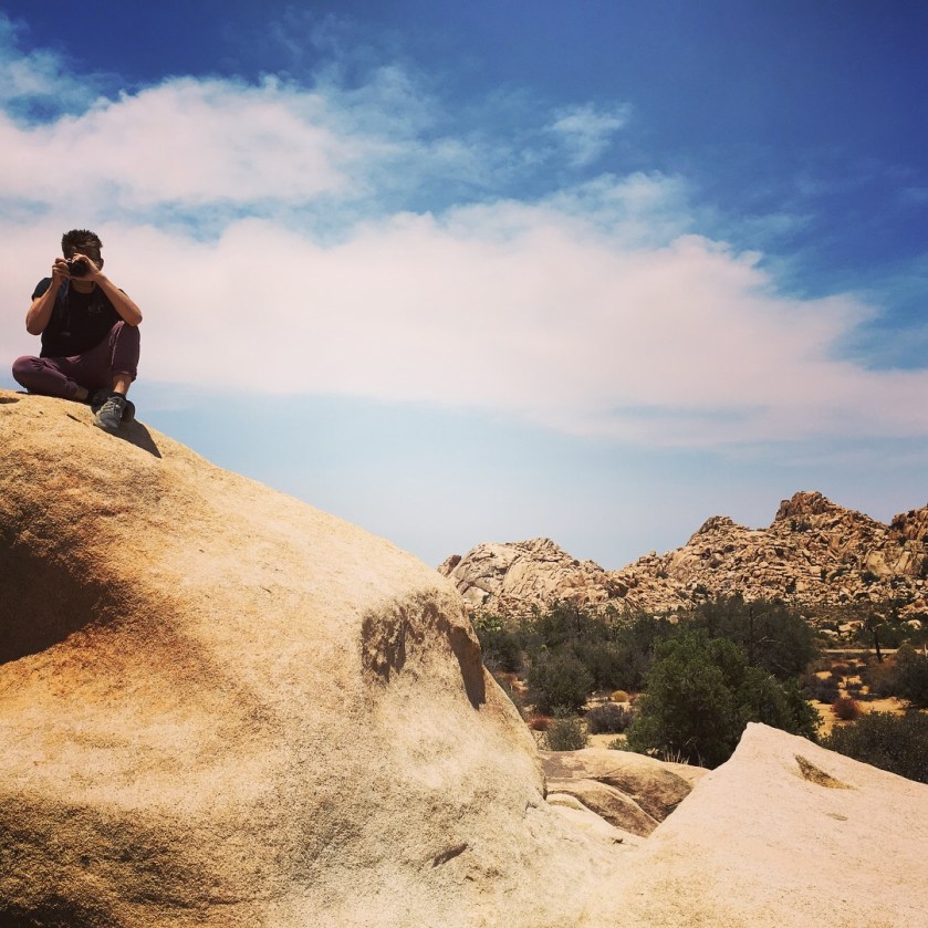
We arrived at Joshua Tree NP about 45 minutes past the salt flat and immediately went to the visitor’s center to get our park stamps. The Ranger warned us about a large wildfire to the west, exactly in the direction we were heading so he advised us about routes to avoid and we headed into the park.
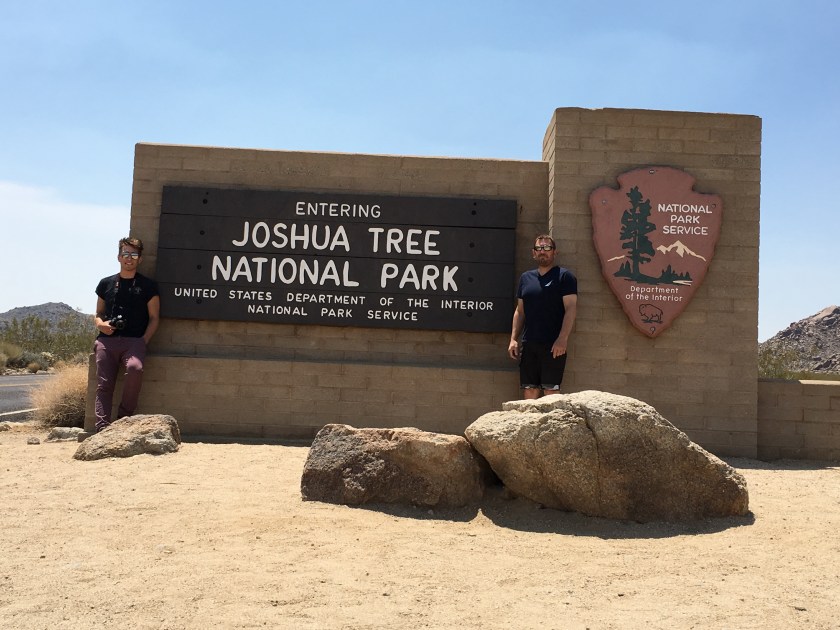
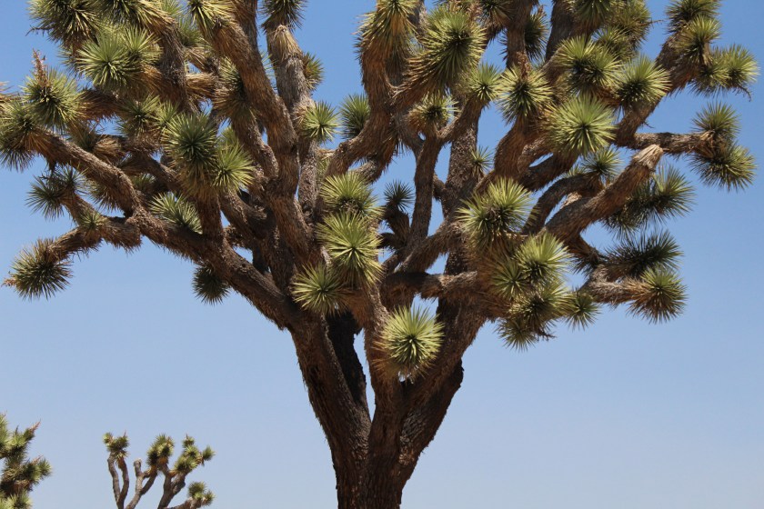
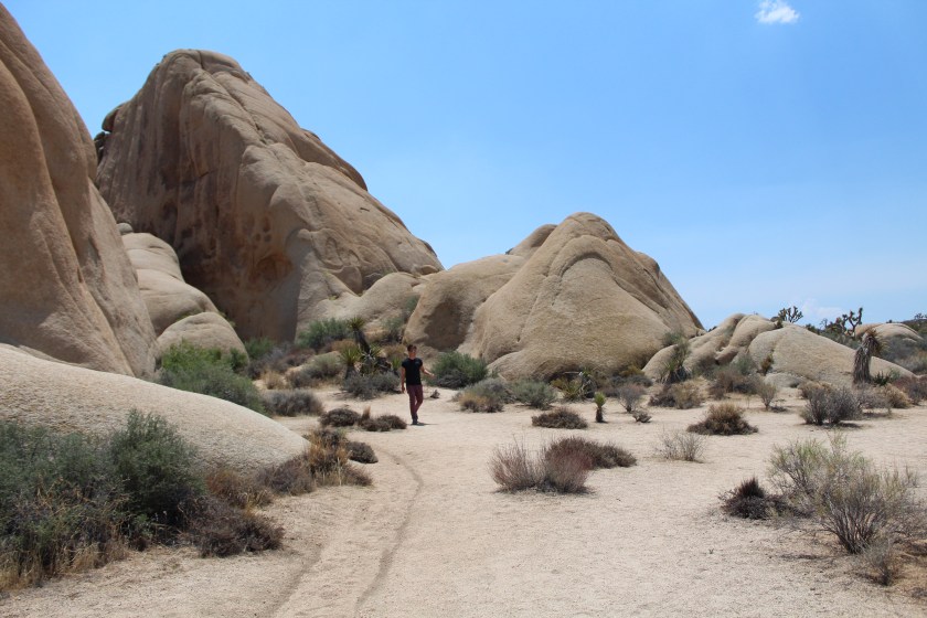
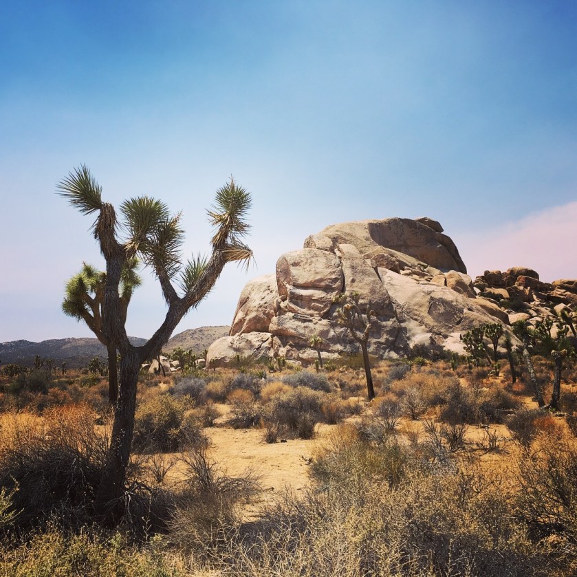
Joshua Tree NP is uniquely beautiful with its own rock formations and native trees after which it is named. We stopped at a few places and did some short rock scrambles in the sunny, 114 degree heat. It’s a pretty neat place and I’d wished we had more time and lower temperatures to do some actual hiking.
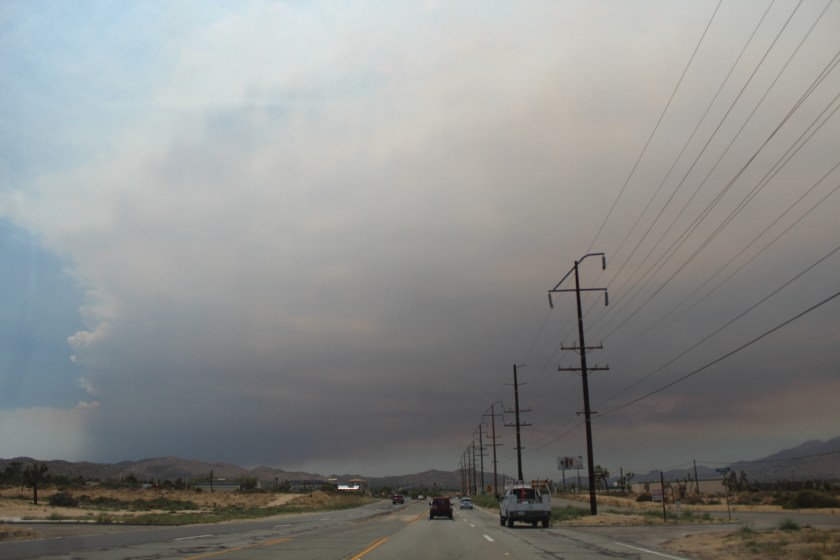
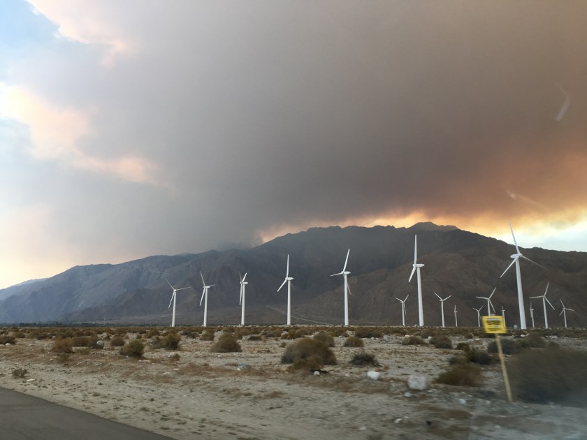
On the road out of Joshua Tree and towards Palm Springs we could see some ominous looking clouds that turned out not to be regular clouds at all. We didn’t expect to see such an expanse of smoke from the wildfire that the Ranger told us about. It loomed large over the mountains.
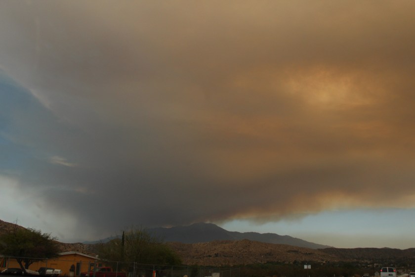
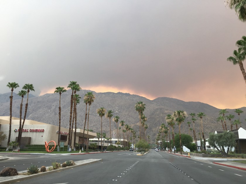
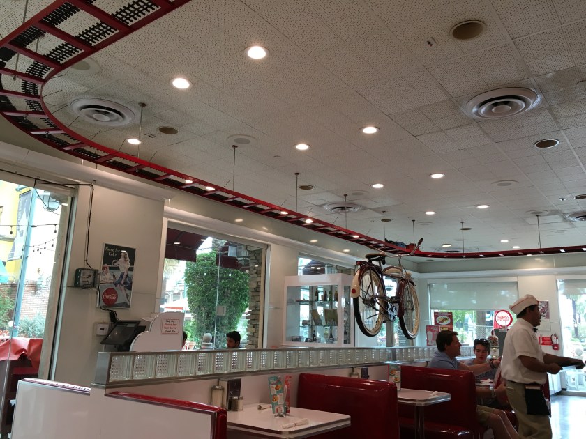
Arriving in Palm Springs we could see glow from the Cranston Fire on the other side of the mountain near Mount San Jacinto State Park. The fire was over 11,000 acres, still growing, and only 5 percent contained. We wondered if we’d be able to keep our driving route on towards San Diego. We decided to have a quick lunch and found Ruby’s Diner, a great hamburger and shake place in the old-fashioned diner style.
After our excellent burgers and shakes we decided to hit the road not knowing what the fire had in store for our trip. We stopped to get gas and saw what looked like snow flakes coming down everywhere but quickly realized it was ashes from the fire. On our way out of town we saw thousands of wind turbines back-dropped by thick orange smoke on the mountain.
Fortunately our route took us south of the fire and in two hours we arrived at our destination, Rancho Bernardo, a district of San Diego to the north. However, we were greeted by another fire, but this time it was a small brush fire yet big enough to close our exit. Man it sure is dry in the southwest.

Day 9 · July 27 · San Diego
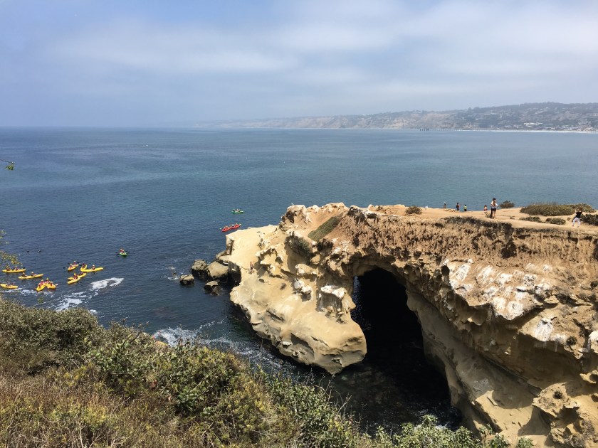
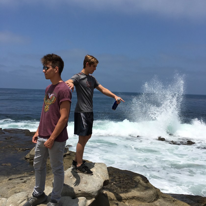
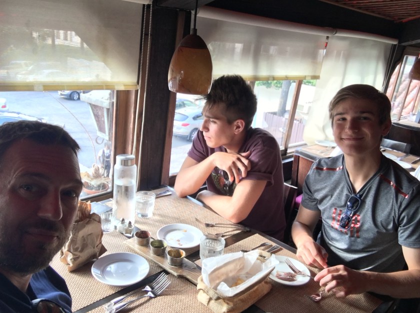
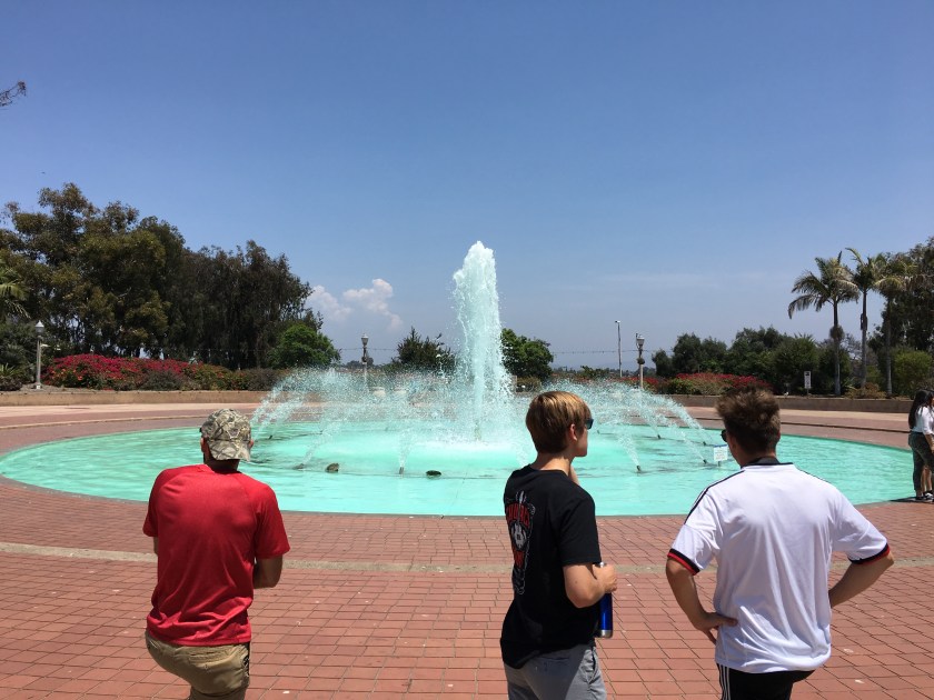
On our first full day in San Diego after meeting-up with my older son, we drove to La Jolla and walked along the shore spotting swimmers, kayakers, snorkelers and seals. We kind of regretted not bringing swim suits and trying the snorkeling. La Jolla is a very hilly place which provided great vistas of the shore and ocean. Parking close to the beach is a challenge. There are a couple of garages and street parking. There is a nice beach sandwiched between large sections of rocks that provide access to the water for everyone. After buying our ‘Save The Ocean’ t-shirts we walked along the rocks to watch and listen to the funny seals. Just so you aren’t surprised – if you don’t like farm smells you won’t like the smell of the area here, but the incredible scenery around the rocky ocean shore may quickly make you forget about any offending odors.
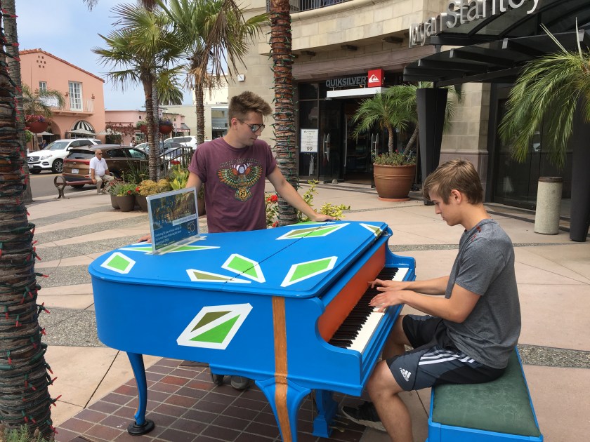
The Brockton Villa Restaurant turned out to be a great lunch spot with amazing views of La Jolla Cove and the ocean. It was a little expensive, but the food and service were as excellent as the view and well worth it. After lunch we walked up the hill to a main street with plenty of stores and restaurants. They even have outdoor pianos and they encourage people to play so my older played a few familiar tunes to the crowd’s liking. La Jolla is a definite must stop, see and experience type of place.
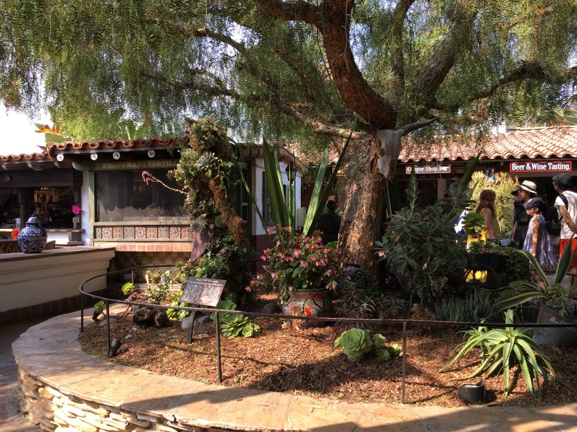
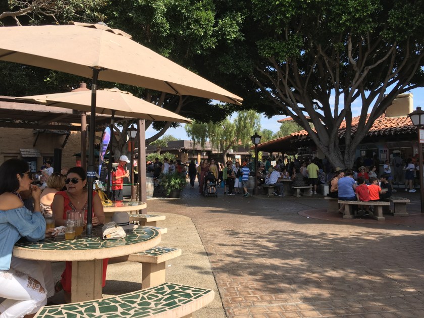
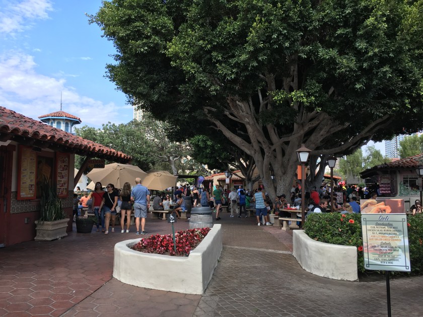
After lunch we drove to Old Town San Diego, a very cool 1800’s era original section of the city. There is big park in the center of Old Town with shade trees and benches, and both sides of the park are lined with shops, museums and a few places to eat. Definitely check out the hot sauce, olive oil and root beer shops.
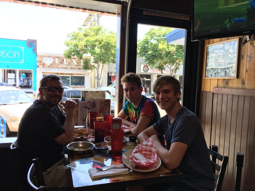
Walking out of Old Town a few blocks southeast there were several Mexican restaurants with outdoor seating that looked very nice. However, we had our eye on El Agave, known for some of the best authentic Mexican food in the city. It was some of the best and freshest food we’ve ever experienced so it did not disappoint.
Later in the evening we went to my older son’s condo and watched Ready Player One. It was a great movie and a chill way to end the day.
Day 10 · July 28 · San Diego
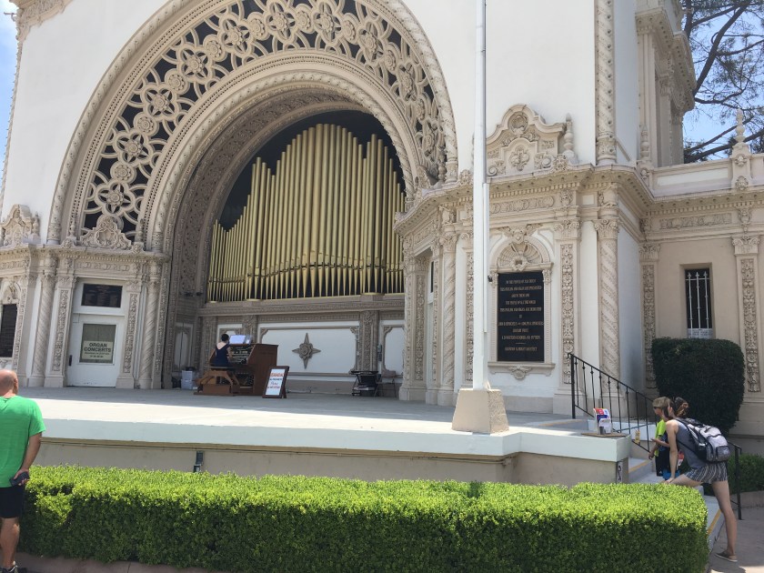
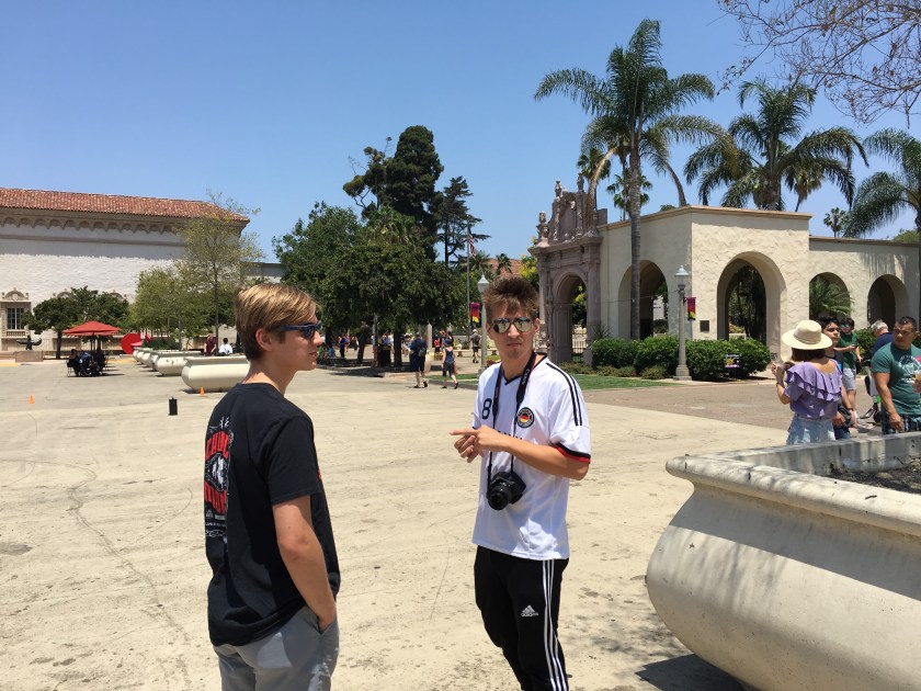
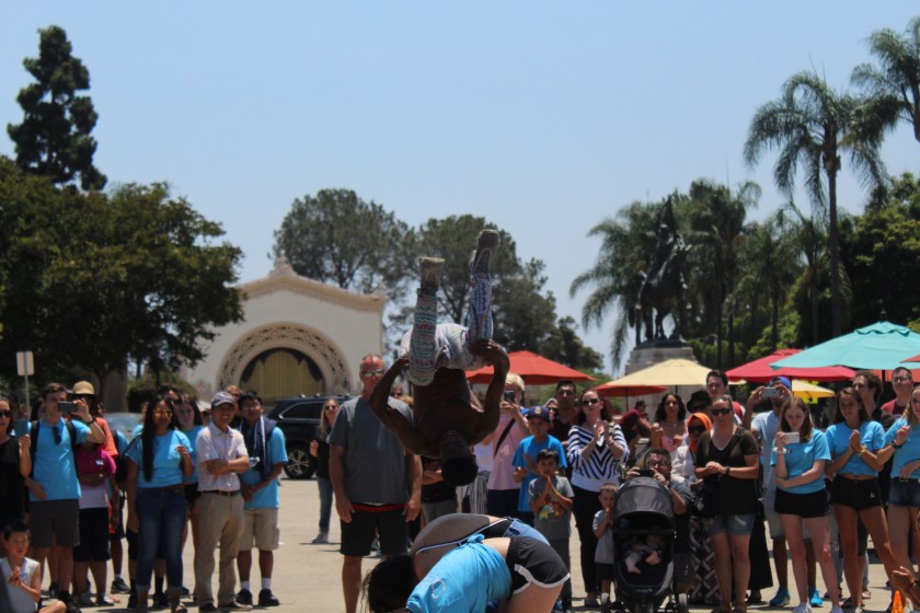
Breakfast at IHOP turned out to be better than the Hilton Garden breakfast and was about the same price. After breakfast we headed down to Balboa Park to walk around and see the beautiful Spanish architecture. There are a bunch of museums as well as gardens and open space in Balboa, including a large stone plaza in front of the art museum where street performers were amusing the crowd with antics and acrobatics. Most museums there charge a fee so that combined with the time, and our level of energy and interest had us only visiting the automotive museum where both antique cars and motorcycles as well as automotive art were on display.
We left Balboa and drove through the Gaslamp Quarter and along the waterfront. On our way back to Rancho Bernardo we stopped at the Fashion Plaza mall for some quick shopping then headed back to the condo to relax before dinner at Urge in Rancho Bernardo. The burgers, salmon and steak at Urge were very good as was the atmosphere and service. Afterwards we went back to my older son’s condo, finished watching a movie and hit the hot tub for a while. Another great way to end a beautiful day in San Diego.
Day 11 · July 29 · San Diego
We had a full day planned for our final day in San Diego since we weren’t flying out until 10pm. The first stop was City Church where my older son had invited us to attend a service. It turned out to be a pretty rocking gathering of some very nice people with live music, great singing and a giant screen. I’ve never been to any service quite like it. From there we headed to Pacific Beach to stop at Buffalo Exchange, another retro 1980’s clothing shop. We found some cool shirts and afterwards had a great burger lunch at Bub’s across the street.
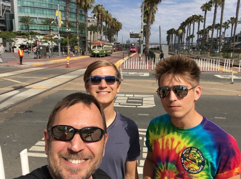
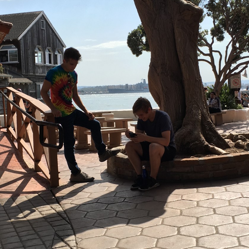
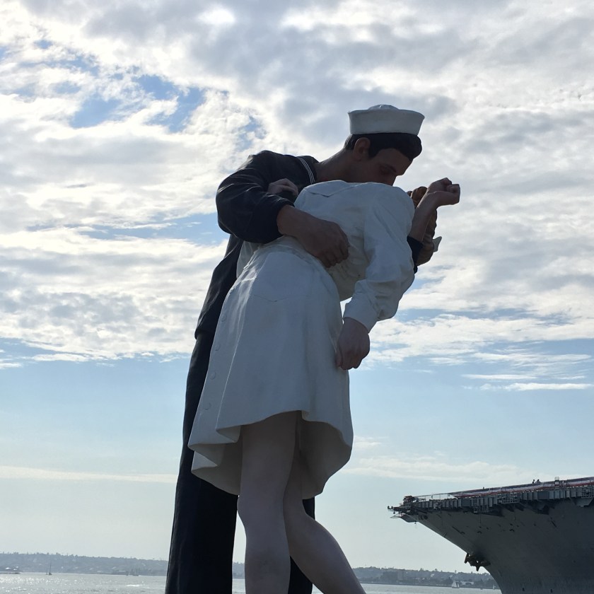
It was a beautiful day so after Bub’s we headed to downtown San Diego and tried to see Coronado. After driving around for a while we couldn’t find parking so we headed back to the Gaslamp Quarter. A garage on 3rd and G Street turned out to be pretty convenient. From there it was an easy two block walk to Gaslamp and we immediately found a bunch of places to eat. Walking south a few blocks more and past the trolleys put us in Seaport, a really cool area along the waterfront with lots of shops and food. We spent quite a bit of time walking around and stopped for a while to listen to a modern flute concert in Seaport. We shopped for souveniers and walked along the waterfront on our way back to Gaslamp. Finally we headed back to Rancho Bernardo to drop off my older son and made our way to the airport. What a great day to cap off an amazing trip to San Diego.
Planning and Gear
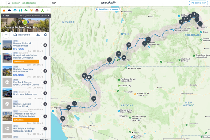
We did a lot of research on the towns, attractions and national parks before finalizing our plan. The NPS.gov website is a great place to start if you are looking for national park information. I used Roadtrippers to plan the route and the stops, trying to leave adequate sightseeing and driving time to make the most of our 10 days. You can add stops to your list and see how long the drive is between them. I used this technique to plan trip segments. Plan a little slack time in too for unexpected excursions or weather related problems. Hotels have different check in times so we took that into consideration to stretch our days to the max. Always know how long it will take to get to your next stop and know when to leave that spectacular spot where you are.
The only things I wished that we brought on the trip were a real GPS unit for use in areas where we lost phone service, and a second camera battery. Internet service overall was not great in our hotels from Rocky Mountain National Park to Bryce Canyon. We bought a second SD memory card in Moab for the camera since we were unable to upload photos to the cloud that we’d transferred to our Chromebook and we wanted to keep the photos on the original memory card as a backup. The Chromebook with 128GB of memory didn’t have enough space for all of our photos and videos so a laptop or 2-in-1 with a bigger hard drive would have been better.
Some items we found very useful on our road trip:
- plenty of phone charger cords and wall plugs
- chromebook for research
- suction cup phone mount for car windshield
- separate charge cords for the car and hotel room
- backpacks with water bladder (e.g. CamelBak)
- portable phone charger for backpack
- sunscreen, sunglasses & cleaning cloth, and hats
- a styrofoam cooler
- mapping routes ahead of time and saving screen snapshots of them
- Windex and paper towels
- trail bars, apples, peanut butter, jelly, loaves of bread and a butter knife
- lots and lots of water

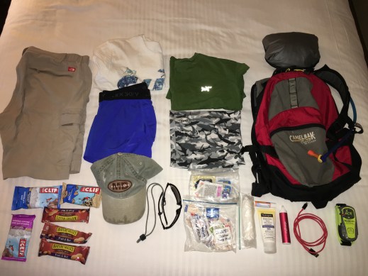
I hiked around Las Vegas during the previous summer and fine-tuned my hiking gear to be cool and lightweight. I prefer white cotton shirts and wicking underwear and shorts when it is hot and dry. A wicking multipurpose buff that can cover your ears and neck is a must have as is a hat and sunglasses. Smartwool socks are also fantastic. If you hike by yourself on lightly traveled trails you may want to consider a PLB (Personal Locator Beacon – the green thing at the bottom right of the photo). If you use a phone or GPS to navigate trails, always carry a map and compass as a backup.
My preferences for a bare-minimum first aid kit below.


A couple of types of my preferred hiking footwear below. Note – sandals aren’t really meant for rocky trails but I find them more comfortable for really hot, dry weather where the trails are packed dirt or sand.


Conclusion
We had a blast and it really was epic! Denver to San Diego in under 10 days was an aggressive schedule considering the number of places we wanted to stop and the number of things to do at those places. You may want to allocate more time to do more hiking in a number of the national parks and other cool places along the way. Do a ton of research ahead of time and visit the park websites to look for current conditions. The southwest is brutally hot in the summer so plan accordingly. The sun is relentless and in many of the parks there isn’t much shade. Take plenty of water and snacks, charge your phone and camera batteries whenever you can, wear sunglasses, wear a hat, use sunscreen, keep your gas tank as full as possible, and expect the unexpected. That said, you only live once so DO IT!
